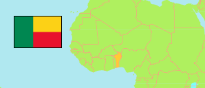
Atacora
Department in Benin
Contents: Subdivision
The population development in Atacora as well as related information and services (Wikipedia, Google, images).
| Name | Status | Population Census 1979-03-20 | Population Census 1992-02-15 | Population Census 2002-02-15 | Population Census 2013-05-11 | |
|---|---|---|---|---|---|---|
| Atacora | Department | 294,629 | 400,613 | 549,417 | 772,262 | |
| Boukoumbé | Commune | 47,049 | 58,196 | 60,568 | 82,450 | → |
| Cobly | Commune | 26,796 | 38,382 | 46,660 | 67,603 | → |
| Kérou | Commune | 27,489 | 42,491 | 62,632 | 100,197 | → |
| Kouandé | Commune | 42,614 | 50,379 | 80,261 | 111,540 | → |
| Matéri | Commune | 46,274 | 58,516 | 83,721 | 113,958 | → |
| Natitingou | Commune | 39,089 | 57,153 | 75,620 | 103,843 | → |
| Pehonko (Péhunco) | Commune | 22,880 | 33,833 | 55,082 | 78,217 | → |
| Tanguiéta | Commune | 27,242 | 40,430 | 54,719 | 74,675 | → |
| Toucountouna | Commune | 15,196 | 21,233 | 30,154 | 39,779 | → |
| Benin | Republic | 3,331,210 | 4,915,555 | 6,769,914 | 10,008,749 |
Source: Institut National de la Statistique Benin (web).
Explanation: The area figures are not reliable.