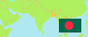
Dhantala
Union in Rangpur Municipal Division
Contents: Population
The population development of Dhantala as well as related information and services (Wikipedia, Google, images).
| Name | Status | Transcription | Native | Population Census 1991-03-13 | Population Census 2001-01-22 | Population Census 2011-03-15 | |
|---|---|---|---|---|---|---|---|
| Dhantala | Union | Dhanatalā | ধনতলা ইউনিয়ন | 17,959 | 19,206 | 22,209 | |
| Rangpur | Division | Raṁpura | রংপুর বিভাগ | 11,997,979 | 13,847,150 | 15,787,758 |
Source: Bangladesh Bureau of Statistics (web).
Explanation: Unions and most municipalities in the boundaries of 2011. Districts and some fused municipalities in 2020 boundaries. Some area figures of union councils and municipalities are derived from geospatial data.
Further information about the population structure:
| Gender (C 2011) | |
|---|---|
| males | 11,180 |
| females | 11,029 |
| Urbanization (C 2011) | |
|---|---|
| Rural | 22,209 |