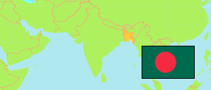
Rangamati
District in Bangladesh
Contents: Subdivision
The population development in Rangamati as well as related information and services (Wikipedia, Google, images).
| Name | Status | Transcription | Native | Population Census 1991-03-13 | Population Census 2001-01-22 | Population Census 2011-03-15 | Population Census 2022-06-14 | |
|---|---|---|---|---|---|---|---|---|
| Rangamati | District | Rāṅgāmāṭi | রাঙ্গামাটি জেলা | 401,388 | 508,182 | 595,979 | 647,586 | |
| Baghaichhari | Subdistrict | Bāghāichaṛi | বাঘাইছড়ি উপজেলা | 57,380 | 78,519 | 96,899 | 106,282 | → |
| Barkal | Subdistrict | Barakala | বরকল উপজেলা | 28,839 | 39,781 | 47,523 | 49,707 | → |
| Belaichhari | Subdistrict | Bilāichaṛi | বিলাইছড়ি উপজেলা | 17,973 | 24,154 | 28,525 | 29,540 | → |
| Juraichhari | Subdistrict | Jurāchaṛi | জুরাছড়ি উপজেলা | 11,621 | 22,277 | 27,786 | 26,932 | → |
| Kaptai | Subdistrict | Kāptāi | কাপ্তাই উপজেলা | 60,185 | 66,135 | 59,693 | 55,408 | → |
| Kawkhali [Betbunia] | Subdistrict | Kāukhālī | কাউখালী উপজেলা | 42,409 | 48,240 | 59,578 | 66,309 | → |
| Langadu | Subdistrict | Laṁgadu | লংগদু উপজেলা | 54,490 | 68,014 | 81,548 | 90,406 | → |
| Naniarchar | Subdistrict | Nāniẏāracara | নানিয়ারচর উপজেলা | 34,561 | 39,190 | 43,616 | 48,521 | → |
| Rajasthali | Subdistrict | Rājasthalī | রাজস্থলী উপজেলা | 17,198 | 22,611 | 26,083 | 27,864 | → |
| Rangamati Sadar | Subdistrict | Rāṅgāmāṭi Sadara | রাঙ্গামাটি সদর উপজেলা | 76,732 | 99,261 | 124,728 | 146,591 | → |
| Bangladesh | People's Republic | Bā̃lādēśa | বাংলাদেশ | 106,314,992 | 124,355,263 | 144,043,697 | 165,158,616 |
Source: Bangladesh Bureau of Statistics.
Explanation: The tabulated figures are not adjusted for underenumeration. 2022 subdistrict figures exclude hijra. Some area figures are derived from geospatial data.