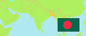
Nilphamari
District in Bangladesh
Contents: Subdivision
The population development in Nilphamari as well as related information and services (Wikipedia, Google, images).
| Name | Status | Transcription | Native | Population Census 1991-03-13 | Population Census 2001-01-22 | Population Census 2011-03-15 | Population Census 2022-06-14 | |
|---|---|---|---|---|---|---|---|---|
| Nilphamari | District | Nīlaphāmārī | নীলফামারী জেলা | 1,348,762 | 1,571,690 | 1,834,231 | 2,092,568 | |
| Dimla | Subdistrict | Ḍimalā | ডিমলা উপজেলা | 187,696 | 223,975 | 283,438 | 316,838 | → |
| Domar | Subdistrict | Ḍōmāra | ডোমার উপজেলা | 175,507 | 215,699 | 249,429 | 282,626 | → |
| Jaldhaka | Subdistrict | Jalaḍhākā | জলঢাকা উপজেলা | 233,885 | 274,736 | 340,672 | 386,790 | → |
| Kishoreganj | Subdistrict | Kiśōragañja | কিশোরগঞ্জ উপজেলা | 246,201 | 253,192 | 261,069 | 269,322 | → |
| Nilphamari Sadar | Subdistrict | Nīlaphāmārī Sadara | নীলফামারী সদর উপজেলা | 306,051 | 371,879 | 435,162 | 523,950 | → |
| Saidpur | Subdistrict | Saiẏadapura | সৈয়দপুর উপজেলা | 199,422 | 232,209 | 264,461 | 312,988 | → |
| Bangladesh | People's Republic | Bā̃lādēśa | বাংলাদেশ | 106,314,992 | 124,355,263 | 144,043,697 | 165,158,616 |
Source: Bangladesh Bureau of Statistics.
Explanation: The tabulated figures are not adjusted for underenumeration. 2022 subdistrict figures exclude hijra. Some area figures are derived from geospatial data.