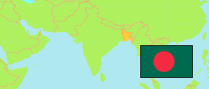
Khagrachhari
District in Bangladesh
Contents: Subdivision
The population development in Khagrachhari as well as related information and services (Wikipedia, Google, images).
| Name | Status | Transcription | Native | Population Census 1991-03-13 | Population Census 2001-01-22 | Population Census 2011-03-15 | Population Census 2022-06-14 | |
|---|---|---|---|---|---|---|---|---|
| Khagrachhari | District | Khāgaṛāchaṛi | খাগড়াছড়ি জেলা | 342,488 | 525,664 | 613,917 | 714,119 | |
| Dighinala | Subdistrict | Dighīnālā | দিঘীনালা উপজেলা | 50,933 | 92,743 | 103,392 | 115,436 | → |
| Guimara [← Matiranga, Ramgarh, Mahalchhari] | Subdistrict | Guimārā | গুইমারা উপজেলা | ... | ... | 44,202 | 53,256 | → |
| Khagrachhari Sadar | Subdistrict | Khāgaṛāchaṛi Sadara | খাগড়াছড়ি সদর উপজেলা | 61,306 | 92,380 | 111,833 | 136,134 | → |
| Lakshmichhari | Subdistrict | Lakṣīchaṛi | লক্ষীছড়ি উপজেলা | 16,676 | 21,745 | 25,994 | 27,148 | → |
| Mahalchhari | Subdistrict | Mahālachaṛi | মহালছড়ি উপজেলা | ... | ... | 42,427 | 49,076 | → |
| Manikchhari | Subdistrict | Mānikachaṛi | মানিকছড়ি উপজেলা | 38,479 | 50,061 | 61,589 | 77,024 | → |
| Matiranga | Subdistrict | Māṭirāṅgā | মাটিরাঙ্গা উপজেলা | ... | ... | 111,538 | 126,604 | → |
| Panchhari | Subdistrict | Pānachaṛi | পানছড়ি উপজেলা | 26,319 | 64,510 | 62,198 | 68,673 | → |
| Ramgarh | Subdistrict | Rāmagaṛa | রামগড় উপজেলা | ... | ... | 50,744 | 60,734 | → |
| Bangladesh | People's Republic | Bā̃lādēśa | বাংলাদেশ | 106,314,992 | 124,355,263 | 144,043,697 | 165,158,616 |
Source: Bangladesh Bureau of Statistics.
Explanation: The tabulated figures are not adjusted for underenumeration. 2022 subdistrict figures exclude hijra. Some area figures are derived from geospatial data.