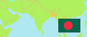
Jhenaidah
District in Bangladesh
Contents: Subdivision
The population development in Jhenaidah as well as related information and services (Wikipedia, Google, images).
| Name | Status | Transcription | Native | Population Census 1991-03-13 | Population Census 2001-01-22 | Population Census 2011-03-15 | Population Census 2022-06-14 | |
|---|---|---|---|---|---|---|---|---|
| Jhenaidah | District | Jhināidaha | ঝিনাইদহ জেলা | 1,361,280 | 1,579,490 | 1,771,304 | 2,005,849 | |
| Harinakundu | Subdistrict | Hariṇākunḍu | হরিণাকুন্ডু উপজেলা | 162,078 | 172,491 | 197,723 | 218,844 | → |
| Jhenaidah Sadar | Subdistrict | Jhināidaha Sadara | ঝিনাইদহ সদর উপজেলা | 333,192 | 394,152 | 455,932 | 543,872 | → |
| Kaliganj | Subdistrict | Kālīgañja | কালীগঞ্জ উপজেলা | 219,126 | 252,443 | 282,366 | 308,474 | → |
| Kotchandpur | Subdistrict | Kōṭacā̃dapura | কোটচাঁদপুর উপজেলা | 107,193 | 132,347 | 141,121 | 156,540 | → |
| Maheshpur | Subdistrict | Mahēśapura | মহেশপুর উপজেলা | 246,350 | 296,248 | 332,514 | 371,269 | → |
| Shailkupa | Subdistrict | Śailakupā | শৈলকুপা উপজেলা | 293,341 | 331,809 | 361,648 | 406,735 | → |
| Bangladesh | People's Republic | Bā̃lādēśa | বাংলাদেশ | 106,314,992 | 124,355,263 | 144,043,697 | 165,158,616 |
Source: Bangladesh Bureau of Statistics.
Explanation: The tabulated figures are not adjusted for underenumeration. 2022 subdistrict figures exclude hijra. Some area figures are derived from geospatial data.