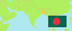
Jaipurhat
District in Bangladesh
Contents: Subdivision
The population development in Jaipurhat as well as related information and services (Wikipedia, Google, images).
| Name | Status | Transcription | Native | Population Census 1991-03-13 | Population Census 2001-01-22 | Population Census 2011-03-15 | Population Census 2022-06-14 | |
|---|---|---|---|---|---|---|---|---|
| Jaipurhat [Joypurhat] | District | Jaẏapurahāṭa | জয়পুরহাট জেলা | 765,011 | 846,696 | 913,768 | 956,431 | |
| Akkelpur | Subdistrict | Ākkēlapura | আক্কেলপুর উপজেলা | 126,046 | 128,952 | 137,619 | 144,676 | → |
| Jaipurhat Sadar | Subdistrict | Jaẏapurahāṭa Sadara | জয়পুরহাট সদর উপজেলা | 225,271 | 256,691 | 289,058 | 315,191 | → |
| Kalai | Subdistrict | Kālāi | কালাই উপজেলা | 114,183 | 129,329 | 143,197 | 146,041 | → |
| Khetlal | Subdistrict | Kṣētalāla | ক্ষেতলাল উপজেলা | 106,146 | 115,918 | 108,326 | 110,843 | → |
| Panchbibi | Subdistrict | Pā̃cabibi | পাঁচবিবি উপজেলা | 193,365 | 215,806 | 235,568 | 239,591 | → |
| Bangladesh | People's Republic | Bā̃lādēśa | বাংলাদেশ | 106,314,992 | 124,355,263 | 144,043,697 | 165,158,616 |
Source: Bangladesh Bureau of Statistics.
Explanation: The tabulated figures are not adjusted for underenumeration. 2022 subdistrict figures exclude hijra. Some area figures are derived from geospatial data.