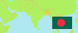
Brahmanbaria
District in Bangladesh
Contents: Subdivision
The population development in Brahmanbaria as well as related information and services (Wikipedia, Google, images).
| Name | Status | Transcription | Native | Population Census 1991-03-13 | Population Census 2001-01-22 | Population Census 2011-03-15 | Population Census 2022-06-14 | |
|---|---|---|---|---|---|---|---|---|
| Brahmanbaria | District | Brāhmaṇabāṛīẏā | ব্রাহ্মণবাড়ীয়া জেলা | 2,141,745 | 2,398,254 | 2,840,498 | 3,306,563 | |
| Akhaura | Subdistrict | Ākhāuṛā | আখাউড়া উপজেলা | 112,982 | 130,319 | 145,215 | 168,451 | → |
| Ashuganj | Subdistrict | Āśugañja | আশুগঞ্জ উপজেলা | 124,556 | 145,828 | 180,654 | 210,347 | → |
| Bancharampur | Subdistrict | Bāñchārāmapura | বাঞ্ছারামপুর উপজেলা | 258,371 | 278,240 | 298,430 | 335,102 | → |
| Bijoynagar [← Brahmanbaria Sadar] | Subdistrict | Bijaẏanagara | বিজয়নগর উপজেলা | ... | ... | 257,247 | 290,424 | → |
| Brahmanbaria Sadar | Subdistrict | Brāhmaṇabāṛiẏā Sadara | ব্রাহ্মণবাড়িয়া সদর উপজেলা | ... | ... | 521,994 | 677,213 | → |
| Kasba | Subdistrict | Kasabā | কসবা উপজেলা | 243,833 | 271,231 | 319,221 | 357,954 | → |
| Nabinagar | Subdistrict | Nabīnagara | নবীনগর উপজেলা | 378,539 | 420,383 | 493,518 | 555,807 | → |
| Nasirnagar | Subdistrict | Nāsiranagara | নাসিরনগর উপজেলা | 234,090 | 255,668 | 309,011 | 346,757 | → |
| Sarail | Subdistrict | Sarāila | সরাইল উপজেলা | 232,406 | 271,101 | 315,208 | 364,352 | → |
| Bangladesh | People's Republic | Bā̃lādēśa | বাংলাদেশ | 106,314,992 | 124,355,263 | 144,043,697 | 165,158,616 |
Source: Bangladesh Bureau of Statistics.
Explanation: The tabulated figures are not adjusted for underenumeration. 2022 subdistrict figures exclude hijra. Some area figures are derived from geospatial data.