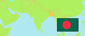
Bagerhat
District in Bangladesh
Contents: Subdivision
The population development in Bagerhat as well as related information and services (Wikipedia, Google, images).
| Name | Status | Transcription | Native | Population Census 1991-03-13 | Population Census 2001-01-22 | Population Census 2011-03-15 | Population Census 2022-06-14 | |
|---|---|---|---|---|---|---|---|---|
| Bagerhat | District | Bāgērahāṭa | বাগেরহাট জেলা | 1,431,332 | 1,549,031 | 1,476,090 | 1,613,076 | |
| Bagerhat Sadar | Subdistrict | Bāgērahāṭa Sadara | বাগেরহাট সদর উপজেলা | 235,848 | 257,273 | 266,389 | 288,649 | → |
| Chitalmari | Subdistrict | Citalamārī | চিতলমারী উপজেলা | 127,524 | 139,862 | 138,810 | 153,033 | → |
| Fakirhat | Subdistrict | Phakirahāṭa | ফকিরহাট উপজেলা | 123,956 | 134,418 | 137,789 | 159,013 | → |
| Kachua | Subdistrict | Kacuẏā | কচুয়া উপজেলা | 93,249 | 100,093 | 97,011 | 107,420 | → |
| Mollahat | Subdistrict | Mōllāhāṭa | মোল্লাহাট উপজেলা | 116,729 | 126,218 | 130,878 | 144,613 | → |
| Mongla | Subdistrict | Mōṁlā | মোংলা উপজেলা | 137,947 | 149,030 | 136,588 | 158,460 | → |
| Morrelganj | Subdistrict | Mōṛēlagañja | মোড়েলগঞ্জ উপজেলা | 321,153 | 349,551 | 294,576 | 304,852 | → |
| Rampal | Subdistrict | Rāmapāla | রামপাল উপজেলা | 167,070 | 178,503 | 154,965 | 176,048 | → |
| Sharankhola | Subdistrict | Śaraṇakhōlā | শরণখোলা উপজেলা | 107,856 | 114,083 | 119,084 | 120,917 | → |
| Bangladesh | People's Republic | Bā̃lādēśa | বাংলাদেশ | 106,314,992 | 124,355,263 | 144,043,697 | 165,158,616 |
Source: Bangladesh Bureau of Statistics.
Explanation: The tabulated figures are not adjusted for underenumeration. 2022 subdistrict figures exclude hijra. Some area figures are derived from geospatial data.