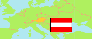
Wiersdorf
in Sankt Peter am Ottersbach (Südoststeiermark District)
Contents: Locality
The population development of Wiersdorf as well as related information and services (weather, Wikipedia, Google, images).
| Name | Commune | Population Census 2001-05-15 | Population Census 2011-10-31 | Population Estimate 2022-01-01 | Population Estimate 2025-01-01 | |
|---|---|---|---|---|---|---|
| Wiersdorf | Sankt Peter am Ottersbach | 164 | 163 | 168 | 151 | → |
Source: Statistik Austria.
Explanation: Localities are defined independently of the type of settlement by municipal and state laws; they may be, e.g., closed settlements, scattered settlements or combinations thereof.