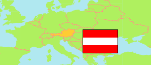
Unterkohlstätten
Commune in Oberwart District
Commune
The population development of Unterkohlstätten.
| Name | Status | Population Census 2001-05-15 | Population Census 2011-10-31 | Population Estimate 2023-01-01 | |
|---|---|---|---|---|---|
| Unterkohlstätten | Commune | 1,103 | 1,030 | 977 | → |
Contents: Localities
The population development of the localities in Unterkohlstätten.
| Name | Status | Commune | Population Census 2001-05-15 | Population Census 2011-10-31 | Population Estimate 2023-01-01 | |
|---|---|---|---|---|---|---|
| Glashütten bei Schlaining | Locality | Unterkohlstätten | 132 | 119 | 109 | → |
| Günseck | Locality | Unterkohlstätten | 194 | 192 | 165 | → |
| Holzschlag | Locality | Unterkohlstätten | 337 | 307 | 287 | → |
| Oberkohlstätten | Locality | Unterkohlstätten | 201 | 189 | 194 | → |
| Unterkohlstätten | Locality | Unterkohlstätten | 239 | 223 | 222 | → |
Source: Statistik Austria.
Explanation: Localities are defined independently of the type of settlement by municipal and state laws; they may be, e.g., closed settlements, scattered settlements or combinations thereof.