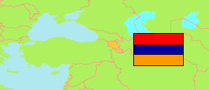
Ararat
Province in Armenia
Contents: Subdivision
The population development in Ararat as well as related information and services (Wikipedia, Google, images).
| Name | Status | Native | Population Census 2001-10-10 | Population Census 2011-10-12 | Population Census 2022-10-13 | Population Estimate 2025-01-01 | |
|---|---|---|---|---|---|---|---|
| Ararat | Province | Արարատի մարզ | 272,016 | 260,367 | 248,982 | 267,600 | |
| Ararat | Municipality | Արարատի համայնք | 41,852 | 41,725 | 37,758 | 39,500 | → |
| Artashat | Municipality | Արտաշատի համայնք | 100,393 | 91,182 | 86,598 | 93,400 | → |
| Masis | Municipality | Մասիսի համայնք | 77,107 | 78,442 | 76,751 | 84,300 | → |
| Vedi | Municipality | Վեդիի համայնք | 50,489 | 47,187 | 46,085 | 48,500 | → |
| Verin Dvin | Municipality | Վերին Դվինի համայնք | 2,175 | 1,831 | 1,790 | 1,900 | → |
| Hayastan [Armenia] | Republic | Հայաստան | 3,213,011 | 3,018,854 | 2,932,731 | 3,076,200 |
Source: National Statistical Service of the Republic of Armenia.
Explanation: Area and density figures of municipalities and city districts are computed by using geospatial data.