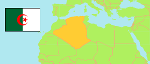
M'Sila
Province in Algeria
Contents: Subdivision
The population development in M'Sila as well as related information and services (Wikipedia, Google, images).
| Name | Status | Native | Population Census 1998-06-25 | Population Census 2008-04-14 | |
|---|---|---|---|---|---|
| M'Sila | Province | المسيلة | 805,519 | 990,591 | |
| Aïn El Hadjel | Commune | عين الحجل | 27,661 | 33,046 | → |
| Aïn El Melh | Commune | عين الملح | 23,272 | 37,045 | → |
| Aïn Errich | Commune | عين الريش | 10,548 | 20,634 | → |
| Aïn Fares | Commune | عين فارس | 3,563 | 3,184 | → |
| Aïn Khadra | Commune | عين خضراء | 19,412 | 29,046 | → |
| Belaiba | Commune | بلعايبة | 20,839 | 27,404 | → |
| Beni Ilmane | Commune | بنى يلمان | 7,478 | 8,777 | → |
| Ben Srour | Commune | بن سرور | 18,893 | 23,953 | → |
| Benzouh | Commune | بن الزوه | 4,197 | 5,636 | → |
| Berhoum | Commune | برهوم | 17,838 | 23,620 | → |
| Bir Foda | Commune | بئر الفضة | 4,463 | 4,258 | → |
| Bou Saâda | Commune | بوسعادة | 104,336 | 125,573 | → |
| Bouti Sayah | Commune | بوطى السايح | 7,806 | 9,042 | → |
| Chellal | Commune | شلال | 4,268 | 5,411 | → |
| Dehahna | Commune | دهاهنة | 6,411 | 6,697 | → |
| Djebel Messaad | Commune | جبل مسعد | 11,344 | 13,948 | → |
| El Hamel | Commune | الهامل | 10,195 | 11,018 | → |
| El Houamed | Commune | الحوامد | 5,948 | 7,800 | → |
| Hammam Dhalaa | Commune | حمام الضلعة | 34,785 | 39,850 | → |
| Khettouti Sed El Djir | Commune | خطوطي صجير | 6,689 | 7,058 | → |
| Khoubana | Commune | خبانة | 6,848 | 7,950 | → |
| Maadid | Commune | المعاضيد | 22,274 | 24,168 | → |
| Maarif | Commune | المعاريف | 10,990 | 13,269 | → |
| Magra | Commune | مقرة | 31,749 | 39,250 | → |
| M'Cif | Commune | مسيف | 10,241 | 12,209 | → |
| Medjedel | Commune | مجدل | 18,616 | 21,058 | → |
| Mohammed Boudiaf | Commune | وادى الشعير | 12,366 | 16,381 | → |
| M'Sila | Province Capital | المسيلة | 123,059 | 156,647 | → |
| M'Tarfa | Commune | المطارفة | 7,621 | 8,074 | → |
| Ouanougha | Commune | ونوغة | 15,190 | 14,397 | → |
| Ouled Addi Guebala | Commune | أولاد عدى القبالة | 22,369 | 25,456 | → |
| Ouled Atia (Menaa) | Commune | أولاد عطية | 7,167 | 8,498 | → |
| Ouled Derradj | Commune | أولاد دراج | 22,851 | 26,644 | → |
| Ouled Madhi | Commune | أولاد ماضى | 6,525 | 7,069 | → |
| Ouled Mansour | Commune | أولاد منصور | 4,896 | 5,731 | → |
| Ouled Sidi Brahim | Commune | أولاد سيدي ابراهيم | 10,188 | 10,716 | → |
| Ouled Slimane | Commune | أولاد سليمان | 2,070 | 4,116 | → |
| Oultem | Commune | ولتام | 1,763 | 2,289 | → |
| Sidi Aïssa | Commune | سيدي عيسى | 57,270 | 72,062 | → |
| Sidi Ameur | Commune | سيدي عامر | 18,721 | 21,623 | → |
| Sidi Hadjeres | Commune | سيدي هجرس | 6,774 | 6,686 | → |
| Sidi M'hamed | Commune | سيدي محمد | 6,225 | 8,300 | → |
| Slim | Commune | سليم | 5,777 | 5,348 | → |
| Souamaa | Commune | الصوامع | 6,424 | 7,189 | → |
| Tamsa | Commune | تامسة | 6,284 | 7,431 | → |
| Tarmount | Commune | تارمونت | 9,438 | 9,954 | → |
| Zarzour | Commune | الزرزور | 1,876 | 5,077 | → |
| Algérie [Algeria] | Republic | الجزائر | 29,100,867 | 34,080,030 |
Source: Office National des Statistiques de l'Algérie (web).
Further information about the population structure:
| Gender (C 2008) | |
|---|---|
| Males | 504,684 |
| Females | 485,907 |
| Age Groups (C 2008) | |
|---|---|
| 0-14 years | 317,912 |
| 15-64 years | 630,121 |
| 65+ years | 42,375 |
| Age Distribution (C 2008) | |
|---|---|
| 0-9 years | 209,481 |
| 10-19 years | 227,983 |
| 20-29 years | 215,777 |
| 30-39 years | 132,493 |
| 40-49 years | 89,257 |
| 50-59 years | 57,908 |
| 60-69 years | 29,297 |
| 70-79 years | 20,292 |
| 80+ years | 7,920 |
| Clustering (C 2008) | |
|---|---|
| in main locality | 666,848 |
| in other settlements | 125,033 |
| scattered | 198,711 |
