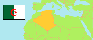
Annaba
Province in Algeria
Contents: Subdivision
The population development in Annaba as well as related information and services (Wikipedia, Google, images).
| Name | Status | Native | Population Census 1998-06-25 | Population Census 2008-04-14 | |
|---|---|---|---|---|---|
| Annaba | Province | عنابة | 557,818 | 609,499 | |
| Aïn Berda | Commune | عين بوردة | 17,446 | 20,611 | → |
| Annaba | Province Capital | عنابة | 247,701 | 257,359 | → |
| Barrahal | Commune | برحال | 18,681 | 22,631 | → |
| Chetaïbi | Commune | شطايبي | 7,583 | 8,035 | → |
| Cheurfa | Commune | الشرفة | 9,386 | 9,875 | → |
| El Bouni | Commune | البوني | 111,956 | 125,265 | → |
| El Eulma | Commune | العلمة | 8,711 | 10,316 | → |
| El Hadjar | Commune | الحجار | 33,878 | 37,364 | → |
| Oued El Aneb | Commune | وادي العنب | 17,306 | 21,088 | → |
| Seraïdi | Commune | سعايدي | 7,193 | 7,626 | → |
| Sidi Amar | Commune | سيدي عامر | 72,889 | 83,254 | → |
| Treat | Commune | تريت | 5,089 | 6,076 | → |
| Algérie [Algeria] | Republic | الجزائر | 29,100,867 | 34,080,030 |
Source: Office National des Statistiques de l'Algérie (web).
Further information about the population structure:
| Gender (C 2008) | |
|---|---|
| Males | 305,030 |
| Females | 304,469 |
| Age Groups (C 2008) | |
|---|---|
| 0-14 years | 143,896 |
| 15-64 years | 428,301 |
| 65+ years | 36,977 |
| Age Distribution (C 2008) | |
|---|---|
| 0-9 years | 94,262 |
| 10-19 years | 106,255 |
| 20-29 years | 121,353 |
| 30-39 years | 101,608 |
| 40-49 years | 77,327 |
| 50-59 years | 54,917 |
| 60-69 years | 29,690 |
| 70-79 years | 17,631 |
| 80+ years | 6,131 |
| Clustering (C 2008) | |
|---|---|
| in main locality | 442,230 |
| in other settlements | 150,214 |
| scattered | 17,056 |