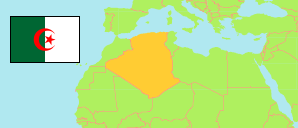
Djelfa
Province in Algeria
Contents: Subdivision
The population development in Djelfa as well as related information and services (Wikipedia, Google, images).
| Name | Status | Native | Population Census 1998-06-25 | Population Census 2008-04-14 | |
|---|---|---|---|---|---|
| Djelfa | Province | الجلفة | 797,706 | 1,092,184 | |
| Aïn Chouhada | Commune | عين الشهداء | 8,337 | 4,549 | → |
| Aïn El Ibel | Commune | عين الابل | 20,436 | 28,406 | → |
| Aïn Feka | Commune | عين فكة | 16,842 | 23,404 | → |
| Aïn Maabed | Commune | عين معبد | 13,183 | 19,997 | → |
| Aïn Oussara | Commune | عين وسارة | 82,597 | 101,239 | → |
| Amourah | Commune | عمورة | 5,879 | 7,744 | → |
| Benhar | Commune | بن هار | 10,380 | 17,207 | → |
| Beni Yagoub | Commune | بنى يعقوب | 6,456 | 9,940 | → |
| Birine | Commune | بيرين | 26,617 | 30,913 | → |
| Bouira Lahdab | Commune | بويرة الأحدب | 8,897 | 10,993 | → |
| Charef | Commune | الشارف | 19,373 | 24,028 | → |
| Dar Chioukh | Commune | دار الشيوخ | 24,870 | 30,372 | → |
| Deldoul | Commune | دلدول | 13,171 | 11,230 | → |
| Djelfa | Province Capital | الجلفة | 164,126 | 289,226 | → |
| Douis | Commune | دويس | 10,356 | 9,344 | → |
| El Guedid | Commune | القديد | 11,059 | 12,833 | → |
| El Idrissia | Commune | الادريسية | 21,279 | 32,900 | → |
| El Khemis | Commune | الخميس | 4,769 | 5,405 | → |
| Faidh El Botma | Commune | فيض البطمة | 20,664 | 32,501 | → |
| Guernini | Commune | قرنيني | 4,038 | 4,594 | → |
| Guettara | Commune | القطارة | 11,151 | 9,926 | → |
| Had-Sahary | Commune | حد الصحارى | 22,277 | 30,451 | → |
| Hassi Bahbah | Commune | حاسي بحبح | 61,790 | 86,421 | → |
| Hassi El Euch | Commune | حاسى العش | 10,834 | 11,692 | → |
| Hassi Fedoul | Commune | حاسى فدول | 12,221 | 13,171 | → |
| Messaad | Commune | مسعد | 77,754 | 102,453 | → |
| M'Liliha | Commune | المليليجة | 13,155 | 14,242 | → |
| Moudjebara | Commune | مجبر | 10,365 | 14,052 | → |
| Oum Laadham | Commune | أم العظام | 13,696 | 23,051 | → |
| Sed Rahal | Commune | سد الرحال | 11,812 | 13,693 | → |
| Selmana | Commune | سلمانة | 14,008 | 19,471 | → |
| Sidi Baizid | Commune | سيدي بايزيد | 11,360 | 7,933 | → |
| Sidi Ladjel | Commune | سيدي لعجال | 11,776 | 13,661 | → |
| Tadmit | Commune | تاعظميت | 6,172 | 10,359 | → |
| Zaafrane | Commune | زعفران | 12,865 | 12,972 | → |
| Zaccar | Commune | زكار | 3,142 | 1,809 | → |
| Algérie [Algeria] | Republic | الجزائر | 29,100,867 | 34,080,030 |
Source: Office National des Statistiques de l'Algérie (web).
Further information about the population structure:
| Gender (C 2008) | |
|---|---|
| Males | 562,207 |
| Females | 529,977 |
| Age Groups (C 2008) | |
|---|---|
| 0-14 years | 402,343 |
| 15-64 years | 645,603 |
| 65+ years | 42,557 |
| Age Distribution (C 2008) | |
|---|---|
| 0-9 years | 273,923 |
| 10-19 years | 258,666 |
| 20-29 years | 222,808 |
| 30-39 years | 132,383 |
| 40-49 years | 89,391 |
| 50-59 years | 54,657 |
| 60-69 years | 32,253 |
| 70-79 years | 19,375 |
| 80+ years | 7,047 |
| Clustering (C 2008) | |
|---|---|
| in main locality | 825,411 |
| in other settlements | 48,805 |
| scattered | 217,966 |
