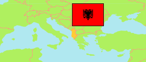
Gramsh
Municipality in Albania
Contents: Subdivision
The population development in Gramsh as well as related information and services (Wikipedia, Google, images).
| Name | Status | Population Census 2001-04-01 | Population Census 2011-10-01 | Population Census 2023-09-18 | |
|---|---|---|---|---|---|
| Gramsh | Municipality | 35,750 | 24,231 | 16,533 | |
| Gramsh | Municipal Unit | 10,533 | 8,440 | 6,786 | → |
| Kodovjat | Municipal Unit | 3,580 | 2,355 | 1,551 | → |
| Kukur | Municipal Unit | 4,034 | 2,560 | 1,386 | → |
| Kushovë | Municipal Unit | 1,352 | 659 | 418 | → |
| Lenie | Municipal Unit | 1,587 | 779 | 486 | → |
| Pishaj | Municipal Unit | 6,351 | 4,906 | 3,341 | → |
| Poroçan | Municipal Unit | 2,044 | 1,269 | 740 | → |
| Skënderbegas | Municipal Unit | 2,215 | 1,239 | 667 | → |
| Sult | Municipal Unit | 1,397 | 631 | 358 | → |
| Tunjë | Municipal Unit | 2,657 | 1,393 | 800 | → |
| Shqipëria [Albania] | Republic | 3,069,275 | 2,821,977 | 2,402,113 |
Source: (2001) pop-stat.mashke.org, (2011) (2023) Instituti i Statistikës, Tiranë.
Explanation: Division according to the reorganization of 2014/15. Area figures are calculated using geospatial data.
Further information about the population structure:
| Gender (C 2023) | |
|---|---|
| Males | 8,420 |
| Females | 8,113 |
| Age Groups (C 2023) | |
|---|---|
| 0-14 years | 2,492 |
| 15-64 years | 10,891 |
| 65+ years | 3,150 |