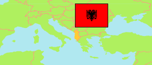
Dimal
Municipality in Albania
Contents: Subdivision
The population development in Dimal as well as related information and services (Wikipedia, Google, images).
| Name | Status | Population Census 2001-04-01 | Population Census 2011-10-01 | Population Census 2023-09-18 | |
|---|---|---|---|---|---|
| Dimal (Ura Vajgurore) | Municipality | 33,642 | 27,295 | 28,135 | |
| Cukalat | Municipal Unit | 4,057 | 3,045 | 2,905 | → |
| Kutalli | Municipal Unit | 11,755 | 9,643 | 10,813 | → |
| Poshnjë | Municipal Unit | 8,649 | 7,375 | 7,208 | → |
| Ura Vajgurore | Municipal Unit | 9,181 | 7,232 | 7,209 | → |
| Shqipëria [Albania] | Republic | 3,069,275 | 2,821,977 | 2,402,113 |
Source: (2001) pop-stat.mashke.org, (2011) (2023) Instituti i Statistikës, Tiranë.
Explanation: Division according to the reorganization of 2014/15. Area figures are calculated using geospatial data.
Further information about the population structure:
| Gender (C 2023) | |
|---|---|
| Males | 13,788 |
| Females | 14,347 |
| Age Groups (C 2023) | |
|---|---|
| 0-14 years | 3,888 |
| 15-64 years | 18,975 |
| 65+ years | 5,272 |