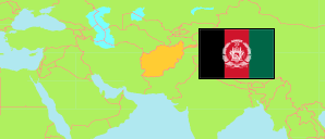
Kandahār
Province in Afghanistan
Contents: Subdivision
The population in Kandahār as well as related information and services (Wikipedia, Google, images).
| Name | Status | Native | Population Projection 2020-09-21 | |
|---|---|---|---|---|
| Kandahār | Province | کندهار | 1,399,594 | |
| Arghandāb | District | ارغنداب | 70,016 | → |
| Arghistān | District | ارغستان | 38,928 | → |
| Dāmān | District | دامان | 39,193 | → |
| Dand [← Kandahār] | Temporary District | ډنډ | 50,752 | → |
| Ghōrak | District | غورک | 10,895 | → |
| Kandahār | Capital District | کندهار | 632,601 | → |
| Khākrēz | District | خاکریز | 25,774 | → |
| Ma'rūf | District | معروف | 37,333 | → |
| Maywand | District | میوند | 66,297 | → |
| Miyāneshīn [Miyanishin] | District | میانشین | 17,006 | → |
| Nēsh | District | نیش | 15,146 | → |
| Panjwā'yī | District | پنجوائی | 98,448 | → |
| Rēg [Shigah] | District | ریگ / شگه | 10,097 | → |
| Shāh Walī Kōt | District | شاهولیکوت | 49,025 | → |
| Shōrābak | District | شورابک | 13,020 | → |
| Spīn Bōldak | District | سپینبولدک | 113,727 | → |
| Takhtah Pul [← Spīn Bōldak] | Temporary District | تخته پل | 14,349 | → |
| Zharay [Zhari] | District | ژری | 96,987 | → |
| Afghānestān [Afghanistan] | Islamic Republic | افغانستان | 32,890,200 |
Source: Central Statistics Office Afghanistan (web).
Explanation: The projection is based on the household listing performed from 2003 to 2005; the reliability of the figures is low. Nomades are only included in the total population of Afghanistan. Area figures of districts are computed by using geospatial data.