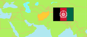
Kunarhā
Province in Afghanistan
Contents: Subdivision
The population in Kunarhā as well as related information and services (Wikipedia, Google, images).
| Name | Status | Native | Population Projection 2020-09-21 | |
|---|---|---|---|---|
| Kunarhā [Kunar] | Province | کنرها | 499,393 | |
| Asad Ābād | Capital District | اسعد آباد | 38,374 | → |
| Barkunar | District | برکنر | 24,844 | → |
| Chapah Darah [Chapa Dara] | District | چپهدره | 35,074 | → |
| Chawkay | District | چوکی | 40,389 | → |
| Dāngām | District | دانگام | 19,132 | → |
| Darah-ye Pēch [Dara-i-Pech] | District | درهپیچ | 61,779 | → |
| Ghāzī Ābād | District | غازیآباد | 21,124 | → |
| Khaṣ Kunar | District | خاصکنر | 39,592 | → |
| Marawarah [Marawara] | District | مروره | 23,118 | → |
| Narang [Narang Aw Badil] | District | نرنگ | 34,145 | → |
| Nārī | District | ناری | 31,222 | → |
| Nūrgal | District | نورگل | 35,739 | → |
| Sheltan [← Shīgal wa Sheltan] | Temporary District | شلتن | 19,497 | → |
| Shīgal [← Shīgal wa Sheltan] | District | شیگل | 13,585 | → |
| Sirkānay | District | سرکانی | 30,823 | → |
| Watahpūr [Watapur] | District | وتهپور | 30,956 | → |
| Afghānestān [Afghanistan] | Islamic Republic | افغانستان | 32,890,200 |
Source: Central Statistics Office Afghanistan (web).
Explanation: The projection is based on the household listing performed from 2003 to 2005; the reliability of the figures is low. Nomades are only included in the total population of Afghanistan. Area figures of districts are computed by using geospatial data.