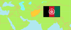
Wardak
Province in Afghanistan
Contents: Subdivision
The population in Wardak as well as related information and services (Wikipedia, Google, images).
| Name | Status | Native | Population Projection 2020-09-21 | |
|---|---|---|---|---|
| Wardak [Maīdān Wardak] | Province | وردک | 660,258 | |
| Chak-e Wardak [Chaki Wardak] | District | چک وردک | 95,392 | → |
| Dāymīrdād | District | دایمیرداد | 35,075 | → |
| Hiṣah-e Awal-e Behsūd [Hesa Awal Behsood] | District | حصه اول بهسود | 41,850 | → |
| Jaghatū [Jaghatu (Wardak)] | District | جغتو | 51,682 | → |
| Jalrayz [Jalrez] | District | جلریز | 59,920 | → |
| Maīdān Shahr [Maidan Shar] | Capital District | میدانشهر | 45,787 | → |
| Markaz-e Bihsūd [Markazi Bihsud] | District | مرکز بهسود | 134,852 | → |
| Nirkh | District | نرخ | 64,436 | → |
| Sayd'ābād | District | سیدآباد | 131,264 | → |
| Afghānestān [Afghanistan] | Islamic Republic | افغانستان | 32,890,200 |
Source: Central Statistics Office Afghanistan (web).
Explanation: The projection is based on the household listing performed from 2003 to 2005; the reliability of the figures is low. Nomades are only included in the total population of Afghanistan. Area figures of districts are computed by using geospatial data.