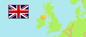
Holywood
Teilgebiet in Urbanes Gebiet Belfast
Übersicht: Gliederung
Die Einwohnerentwicklung in Holywood sowie verwandte Informationen und Dienste (Wikipedia, Google, Bilder).
| Name | Status | Einwohner Zensus 2001-04-29 | Einwohner Zensus 2011-03-27 | Einwohner Schätzung 2020-06-30 | |
|---|---|---|---|---|---|
| Holywood | Teilgebiet | 11.182 | 11.279 | 11.028 | |
| Craigavad 4219 | Statistisches Gebiet | 362 | 318 | 337 | → |
| Cultra 4236 | Statistisches Gebiet | 316 | 309 | 304 | → |
| Cultra 4237 | Statistisches Gebiet | 278 | 278 | 284 | → |
| Cultra 4238 | Statistisches Gebiet | 332 | 346 | 346 | → |
| Cultra 4239 | Statistisches Gebiet | 304 | 272 | 316 | → |
| Cultra 4240 | Statistisches Gebiet | 309 | 340 | 331 | → |
| Cultra 4241 | Statistisches Gebiet | 278 | 274 | 275 | → |
| Cultra 4242 | Statistisches Gebiet | 365 | 364 | 374 | → |
| Holywood Demesne 4270 | Statistisches Gebiet | 292 | 461 | 441 | → |
| Holywood Demesne 4271 | Statistisches Gebiet | 285 | 291 | 290 | → |
| Holywood Demesne 4272 | Statistisches Gebiet | 262 | 252 | 216 | → |
| Holywood Demesne 4273 | Statistisches Gebiet | 463 | 397 | 413 | → |
| Holywood Demesne 4274 | Statistisches Gebiet | 278 | 296 | 234 | → |
| Holywood Demesne 4275 | Statistisches Gebiet | 282 | 277 | 285 | → |
| Holywood Demesne 4276 | Statistisches Gebiet | 368 | 458 | 451 | → |
| Holywood Demesne 4277 | Statistisches Gebiet | 348 | 309 | 323 | → |
| Holywood Demesne 4278 | Statistisches Gebiet | 261 | 271 | 260 | → |
| Holywood Priory 4279 | Statistisches Gebiet | 312 | 325 | 333 | → |
| Holywood Priory 4280 | Statistisches Gebiet | 326 | 318 | 312 | → |
| Holywood Priory 4281 | Statistisches Gebiet | 351 | 424 | 475 | → |
| Holywood Priory 4282 | Statistisches Gebiet | 200 | 229 | 251 | → |
| Holywood Priory 4283 | Statistisches Gebiet | 324 | 340 | 369 | → |
| Holywood Priory 4284 | Statistisches Gebiet | 354 | 364 | 344 | → |
| Holywood Priory 4285 | Statistisches Gebiet | 402 | 358 | 368 | → |
| Holywood Priory 4286 | Statistisches Gebiet | 354 | 317 | 330 | → |
| Loughview 4287 | Statistisches Gebiet | 714 | 615 | 688 | → |
| Loughview 4288 | Statistisches Gebiet | 212 | 220 | 232 | → |
| Loughview 4289 | Statistisches Gebiet | 205 | 220 | 214 | → |
| Loughview 4290 | Statistisches Gebiet | 602 | 583 | 581 | → |
| Loughview 4292 | Statistisches Gebiet | 244 | 204 | 279 | → |
| Loughview 4293 | Statistisches Gebiet | 191 | 236 | 244 | → |
| Loughview 4294 | Statistisches Gebiet | 1.008 | 1.013 | 528 | → |
| Belfast | Urbanes Gebiet | 579.276 | 595.879 | 616.165 |
Quelle: The Northern Ireland Statistics and Research Agency (web)
Weitere Informationen zur Bevölkerungstruktur:
| Geschlecht (C 2011) | |
|---|---|
| männlich | 5.515 |
| weiblich | 5.742 |
| Altersgruppen (C 2011) | |
|---|---|
| 0-17 Jahre | 2.319 |
| 18-64 Jahre | 6.823 |
| ≥65 Jahre | 2.115 |
| Altersverteilung (C 2011) | |
|---|---|
| 0-14 Jahre | 1.945 |
| 15-29 Jahre | 2.217 |
| 30-44 Jahre | 2.050 |
| 45-59 Jahre | 2.278 |
| 60-74 Jahre | 1.743 |
| 75-89 Jahre | 901 |
| ≥90 Jahre | 123 |
| Staatsangehörigkeit (C 2011) | |
|---|---|
| Vereinigtes Königreich | 8.951 |
| Rep. Irland | 1.213 |
| EU (übrige) | 93 |
| anderer Staat | 304 |
| kein Pass | 1.187 |
| Geburtsland (C 2011) | |
|---|---|
| Nordirland | 8.680 |
| Großbritannien | 1.672 |
| Rep. Irland | 261 |
| EU (übrige) | 178 |
| anderer Staat | 466 |
| Ethnische Gruppe (C 2011) | |
|---|---|
| Weiße | 10.918 |
| Asiaten | 128 |
| Schwarze | 115 |
| gemischt/mehrere | 51 |
| andere Ethnie | 45 |
| Religion (C 2011) | |
|---|---|
| römisch-katholisch | 2.243 |
| christlich (andere) | 5.732 |
| andere Religion | 168 |
| keine Religon | 2.507 |
| Umgangssprache (A3+) (C 2011) | |
|---|---|
| Englisch | 10.641 |
| Gälisch | 19 |
| Polnisch | 18 |
| andere Sprache | 186 |