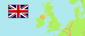
Newtownbreda
Teilgebiet in Urbanes Gebiet Belfast
Übersicht: Gliederung
Die Einwohnerentwicklung in Newtownbreda sowie verwandte Informationen und Dienste (Wikipedia, Google, Bilder).
| Name | Status | Einwohner Zensus 2001-04-29 | Einwohner Zensus 2011-03-27 | Einwohner Schätzung 2020-06-30 | |
|---|---|---|---|---|---|
| Newtownbreda | Teilgebiet | 14.536 | 15.005 | 15.324 | |
| Beechill 1760 | Statistisches Gebiet | 1.303 | 1.278 | 1.202 | → |
| Beechill 1761 | Statistisches Gebiet | 479 | 503 | 488 | → |
| Beechill 1763 | Statistisches Gebiet | 1.328 | 1.425 | 1.380 | → |
| Cairnshill 1767 | Statistisches Gebiet | 331 | 299 | 303 | → |
| Cairnshill 1768 | Statistisches Gebiet | 313 | 296 | 295 | → |
| Cairnshill 1769 | Statistisches Gebiet | 386 | 374 | 348 | → |
| Cairnshill 1770 | Statistisches Gebiet | 311 | 333 | 310 | → |
| Cairnshill 1771 | Statistisches Gebiet | 344 | 437 | 977 | → |
| Cairnshill 1772 | Statistisches Gebiet | 333 | 278 | 278 | → |
| Cairnshill 1773 | Statistisches Gebiet | 290 | 278 | 284 | → |
| Cairnshill 1774 | Statistisches Gebiet | 336 | 281 | 279 | → |
| Cairnshill 1775 | Statistisches Gebiet | 290 | 301 | 297 | → |
| Cairnshill 1776 | Statistisches Gebiet | 263 | 294 | 268 | → |
| Cairnshill 1777 | Statistisches Gebiet | 339 | 352 | 359 | → |
| Galwally 1839 | Statistisches Gebiet | 310 | 396 | 383 | → |
| Galwally 1840 | Statistisches Gebiet | 412 | 374 | 356 | → |
| Galwally 1841 | Statistisches Gebiet | 306 | 345 | 357 | → |
| Galwally 1842 | Statistisches Gebiet | 280 | 258 | 283 | → |
| Galwally 1843 | Statistisches Gebiet | 365 | 326 | 318 | → |
| Galwally 1844 | Statistisches Gebiet | 301 | 297 | 299 | → |
| Galwally 1845 | Statistisches Gebiet | 290 | 292 | 293 | → |
| Galwally 1846 | Statistisches Gebiet | 295 | 279 | 269 | → |
| Knockbracken 1871 | Statistisches Gebiet | 338 | 355 | 377 | → |
| Knockbracken 1872 | Statistisches Gebiet | 254 | 256 | 284 | → |
| Knockbracken 1873 | Statistisches Gebiet | 434 | 806 | 883 | → |
| Knockbracken 1874 | Statistisches Gebiet | 371 | 376 | 389 | → |
| Knockbracken 1875 | Statistisches Gebiet | 329 | 291 | 277 | → |
| Knockbracken 1876 | Statistisches Gebiet | 321 | 332 | 281 | → |
| Knockbracken 1877 | Statistisches Gebiet | 316 | 282 | 307 | → |
| Knockbracken 1878 | Statistisches Gebiet | 349 | 307 | 293 | → |
| Knockbracken 1879 | Statistisches Gebiet | 331 | 352 | 323 | → |
| Newtownbreda 1911 | Statistisches Gebiet | 275 | 290 | 278 | → |
| Newtownbreda 1913 | Statistisches Gebiet | 295 | 280 | 249 | → |
| Newtownbreda 1914 | Statistisches Gebiet | 302 | 303 | 301 | → |
| Newtownbreda 1915 | Statistisches Gebiet | 578 | 651 | 618 | → |
| Newtownbreda 1916 | Statistisches Gebiet | 258 | 267 | 277 | → |
| Newtownbreda 1917 | Statistisches Gebiet | 325 | 312 | 320 | → |
| Newtownbreda 1918 | Statistisches Gebiet | 255 | 249 | 241 | → |
| Belfast | Urbanes Gebiet | 579.276 | 595.879 | 616.165 |
Quelle: The Northern Ireland Statistics and Research Agency (web)
Weitere Informationen zur Bevölkerungstruktur:
| Geschlecht (C 2011) | |
|---|---|
| männlich | 7.250 |
| weiblich | 7.755 |
| Altersgruppen (C 2011) | |
|---|---|
| 0-17 Jahre | 3.482 |
| 18-64 Jahre | 9.308 |
| ≥65 Jahre | 2.215 |
| Altersverteilung (C 2011) | |
|---|---|
| 0-14 Jahre | 2.860 |
| 15-29 Jahre | 2.523 |
| 30-44 Jahre | 3.418 |
| 45-59 Jahre | 3.329 |
| 60-74 Jahre | 1.830 |
| 75-89 Jahre | 969 |
| ≥90 Jahre | 76 |
| Staatsangehörigkeit (C 2011) | |
|---|---|
| Vereinigtes Königreich | 10.295 |
| Rep. Irland | 3.312 |
| EU (übrige) | 220 |
| anderer Staat | 312 |
| kein Pass | 1.422 |
| Geburtsland (C 2011) | |
|---|---|
| Nordirland | 13.239 |
| Großbritannien | 584 |
| Rep. Irland | 348 |
| EU (übrige) | 253 |
| anderer Staat | 581 |
| Ethnische Gruppe (C 2011) | |
|---|---|
| Weiße | 14.339 |
| Asiaten | 494 |
| Schwarze | 36 |
| gemischt/mehrere | 103 |
| andere Ethnie | 33 |
| Religion (C 2011) | |
|---|---|
| römisch-katholisch | 6.093 |
| christlich (andere) | 5.547 |
| andere Religion | 223 |
| keine Religon | 2.356 |
| Umgangssprache (A3+) (C 2011) | |
|---|---|
| Englisch | 13.922 |
| Gälisch | 16 |
| Polnisch | 109 |
| andere Sprache | 347 |