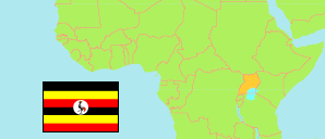
Mbale
Bezirk in Eastern Region
Übersicht: Gliederung
Die Einwohnerentwicklung in Mbale sowie verwandte Informationen und Dienste (Wikipedia, Google, Bilder).
| Name | Status | Einwohner Projektion 2015-07-01 | Einwohner Projektion 2020-07-01 | |
|---|---|---|---|---|
| Mbale | Bezirk | 501.400 | 586.300 | |
| Bubyangu | Subcounty | 21.500 | 25.200 | → |
| Budwale | Subcounty | 7.800 | 9.200 | → |
| Bufumbo | Subcounty | 20.300 | 23.600 | → |
| Bukasakya | Subcounty | 30.400 | 35.600 | → |
| Bukiende | Subcounty | 22.300 | 26.200 | → |
| Bukonde | Subcounty | 19.600 | 22.900 | → |
| Bumasikye | Subcounty | 12.600 | 14.700 | → |
| Bumbobi | Subcounty | 16.700 | 19.600 | → |
| Bungokho | Subcounty | 29.400 | 34.300 | → |
| Bungokho Mutoto | Subcounty | 26.200 | 30.600 | → |
| Busano | Subcounty | 15.200 | 17.800 | → |
| Busiu | Town Council | 2.100 | 2.400 | → |
| Busiu | Subcounty | 22.700 | 26.600 | → |
| Busoba | Subcounty | 21.300 | 24.900 | → |
| Industrial Division | Division | 41.400 | 48.400 | → |
| Lukhonge | Subcounty | 9.900 | 11.600 | → |
| Lwasso | Subcounty | 9.200 | 10.800 | → |
| Nabumali | Town Council | 3.800 | 4.400 | → |
| Nakaloke | Town Council | 28.700 | 33.700 | → |
| Nakaloke | Subcounty | 16.100 | 18.800 | → |
| Namabasa | Subcounty | 7.300 | 8.600 | → |
| Namanyonyi | Subcounty | 31.600 | 36.600 | → |
| Nawuyo | Town Council | 9.100 | 10.700 | → |
| Northern Division | Division | 38.900 | 45.400 | → |
| Nyondo | Subcounty | 8.800 | 10.300 | → |
| Wanale | Division | 14.900 | 17.500 | → |
| Wanale | Subcounty | 13.600 | 15.900 | → |
| Eastern | Region | 9.269.800 | 10.836.500 |
Quelle: Uganda Bureau of Statistics (web).
Erläuterung: Bezirke und Subcountys wie sie Mitte 2019 operativ sind. Die Flächenangaben für Bezirke wurden aus Geodaten abgeleitet. Die Projektion für 2020 berücksichtigt nicht die Bevölkerungszunahme durch Flüchtlinge aus den Nachbarstaaten wie Südsudan.