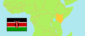
Murang'a
County in Kenia
Übersicht: Gliederung
Die Einwohnerentwicklung in Murang'a sowie verwandte Informationen und Dienste (Wikipedia, Google, Bilder).
| Name | Status | Einwohner Zensus 2009-08-24 | Einwohner Zensus 2019-08-24 | |
|---|---|---|---|---|
| Murang'a | County | 942.581 | 1.056.640 | |
| Aberdare National Park | Nationalpark | 73 | 43 | → |
| Gatanga | Subcounty | 179.352 | 187.989 | → |
| Kahuro | Subcounty | 87.033 | 88.193 | → |
| Kandara | Subcounty | 156.663 | 175.098 | → |
| Kangema | Subcounty | 76.988 | 80.447 | → |
| Kigumo | Subcounty | 123.766 | 136.921 | → |
| Mathioya | Subcounty | 88.177 | 92.814 | → |
| Murang'a East | Subcounty | 94.043 | 110.311 | → |
| Murang'a South | Subcounty | 136.486 | 184.824 | → |
| Kenya [Kenia] | Republik | 38.610.097 | 47.564.296 |
Quelle: Kenya National Bureau of Statistics.
Weitere Informationen zur Bevölkerungstruktur:
| Geschlecht (C 2019) | |
|---|---|
| männlich | 523.940 |
| weiblich | 532.669 |
| divers | 31 |
| Altersgruppen (C 2019) | |
|---|---|
| 0-14 Jahre | 342.523 |
| 15-64 Jahre | 624.482 |
| ≥65 Jahre | 89.590 |
| Altersverteilung (C 2019) | |
|---|---|
| ≥90 Jahre | 5.481 |
| 80-89 Jahre | 16.287 |
| 70-79 Jahre | 39.610 |
| 60-69 Jahre | 58.659 |
| 50-59 Jahre | 87.938 |
| 40-49 Jahre | 119.775 |
| 30-39 Jahre | 140.631 |
| 20-29 Jahre | 140.224 |
| 10-19 Jahre | 223.225 |
| 0-9 Jahre | 224.765 |