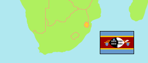
Regionen
Die Einwohnerzahlen der Regionen von Eswatini (Swasiland) gemäß den letzten Volkzählungen und neuesten amtlichen Projektionen.
| Name | Abk. | Hauptstadt | Fläche A (km²) | Einwohner Zensus (Cf) 1976-08-25 | Einwohner Zensus (Cf) 1986-08-25 | Einwohner Zensus (Cf) 1997-05-11 | Einwohner Zensus (C) 2007-05-11 | Einwohner Zensus (C) 2017-05-11 | Einwohner Projektion (P) 2024-07-01 | |||
|---|---|---|---|---|---|---|---|---|---|---|---|---|
| Eswatini | SWZ | Mbabane | 17.364 | 374.571 | 681.059 | 929.718 | 1.018.449 | 1.093.238 | 1.202.300 | |||
| Hhohho | HH | Mbabane | 3.569 | 95.759 | 178.936 | 255.455 | 282.734 | 320.651 | 355.700 | 356900 | ||
| Lubombo | LU | Siteki | 5.947 | 81.800 | 153.958 | 194.323 | 207.731 | 212.531 | 237.500 | 594700 | ||
| Manzini | MA | Manzini | 4.068 | 101.277 | 192.596 | 280.972 | 319.530 | 355.945 | 397.000 | 406800 | ||
| Shiselweni | SH | Nhlangano | 3.779 | 95.735 | 155.569 | 198.978 | 208.454 | 204.111 | 212.200 | 377900 |
- The de facto population is tabulated until 1997. The de jure population of Eswatini was 712,131 in 1986 and 980,722 in 1997.
- Central Statistical Office Swaziland/Eswatini.
Die größten Städte
| Name | Adm. | Einwohner Zensus (C) 2017-05-11 | |
|---|---|---|---|
| 1 | Mbabane | HH | 60.691 |
| 2 | Manzini | MA | 30.248 |
| 3 | Nhlangano | SH | 10.456 |
| 4 | Matsapha | MA | 7.571 |
Übersicht: Städte & Orte
Die Einwohnerzahlen aller Städte und urbanen Orte in Eswatini gemäß Volkszählungen.
| Name | Adm. | Einwohner Zensus (C) 1976-08-25 | Einwohner Zensus (C) 1986-08-25 | Einwohner Zensus (C) 1997-05-11 | Einwohner Zensus (C) 2007-05-11 | Einwohner Zensus (C) 2017-05-11 | Area | |
|---|---|---|---|---|---|---|---|---|
| Bhunya | MA | ... | 3.361 | 2.650 | ... | ... | 0 | |
| Big Bend | LU | 2.083 | 9.676 | 9.374 | 6.320 | 6.433 | 0 | |
| Bulembu (Havelock) | HH | 4.838 | 4.850 | 2.443 | ... | ... | 0 | |
| Ezulwini | LU | ... | ... | ... | 1.423 | 2.661 | 0 | |
| Hlatikulu | SH | 1.183 | 1.276 | 2.076 | ... | ... | 0 | |
| Lavumisa | SH | 765 | 850 | 1.117 | ... | ... | 0 | |
| Malkerns | MA | ... | 4.830 | 7.400 | 5.175 | 6.122 | 0 | |
| Mankayane | MA | 597 | 913 | 1.040 | ... | ... | 0 | |
| Manzini | MA | 10.019 | 18.844 | 25.571 | 28.744 | 30.248 | 0 | |
| Matsapha | MA | ... | ... | ... | 6.126 | 7.571 | 0 | |
| Mbabane | HH | 23.109 | 38.290 | 57.992 | 60.015 | 60.691 | 0 | |
| Mhlambanyatsi | MA | ... | 2.075 | 2.553 | ... | ... | 0 | |
| Mhlume | LU | 3.921 | 6.509 | 7.661 | 3.805 | 3.645 | 0 | |
| Mondi Forest | HH | ... | 2.886 | 2.703 | ... | ... | 0 | |
| Mpaka | LU | ... | 1.007 | 2.144 | ... | ... | 0 | |
| Ngomane | LU | ... | ... | 3.920 | ... | ... | 0 | |
| Ngwenya | HH | ... | 445 | 842 | ... | ... | 0 | |
| Nhlangano | SH | 2.097 | 4.107 | 6.540 | 8.592 | 10.456 | 0 | |
| Nsoko Planters (Nsoka) | LU | ... | 2.868 | 963 | ... | ... | 0 | |
| Pigg's Peak | HH | 2.192 | 3.223 | 4.581 | 4.673 | 5.389 | 0 | |
| Sidvokodvo | MA | 1.530 | 1.339 | 1.528 | ... | ... | 0 | |
| Simunye | LU | ... | ... | 5.333 | 6.132 | 3.173 | 0 | |
| Siteki (Stegi) | LU | 1.362 | 2.271 | 4.157 | 3.906 | 3.663 | 0 | |
| Tabankulu | LU | ... | 4.651 | 2.551 | ... | ... | 0 | |
| Tjaneni | LU | 2.806 | 3.682 | 2.250 | ... | ... | 0 | |
| Vuvulane | LU | ... | ... | 3.594 | ... | ... | 0 |
- (1976) The National Physical Development Plan, Dec. 1995; Statistik des Auslands: Swasiland 1985.
(1986) The National Physical Development Plan, Dec. 1995; The Statesman's Year-Book 1989/90.
(1997) (2007) (2017) Central Statistical Office Swaziland.
Bevölkerungsstruktur
Weitere Informationen über die Bevölkerungsstruktur.
| Geschlecht (C 2017) | |
|---|---|
| männlich | 531.111 |
| weiblich | 562.127 |
| Altersgruppen (C 2017) | |
|---|---|
| 0-17 Jahre | 387.473 |
| 18-64 Jahre | 651.251 |
| ≥65 Jahre | 48.800 |
| Altersverteilung (C 2017) | |
|---|---|
| ≥80 Jahre | 9.039 |
| 70-79 Jahre | 22.402 |
| 60-69 Jahre | 40.228 |
| 50-59 Jahre | 60.634 |
| 40-49 Jahre | 90.974 |
| 30-39 Jahre | 153.351 |
| 20-29 Jahre | 203.255 |
| 10-19 Jahre | 247.605 |
| 0-9 Jahre | 260.036 |
| Geburtsland (C 2017) | |
|---|---|
| Eswatini | 1.070.674 |
| Südafrica | 7.981 |
| Mosambik | 6.351 |
| anderes Land | 8.232 |
