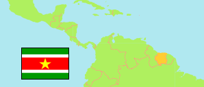
Districts
The population of the districts of Suriname by census years.
| Name | Abbr. | Capital | Area A (km²) | Population Census (C) 1980-07-01 | Population Census (Cf) 2004-08-02 | Population Census (Cf) 2012-08-13 | |||
|---|---|---|---|---|---|---|---|---|---|
| Suriname | SUR | Paramaribo | 163,820 | 354,860 | 492,829 | 541,638 | |||
| Brokopondo | BRO | Brokopondo | 7,364 | 6,621 | 14,215 | 15,909 | 736400 | → | |
| Commewijne | COM | Nieuw Amsterdam | 2,353 | 20,063 | 24,649 | 31,420 | 235300 | → | |
| Coronie | COR | Totness | 3,902 | 2,777 | 2,887 | 3,391 | 390200 | → | |
| Marowijne | MAR | Albina | 4,627 | 16,125 | 16,642 | 18,294 | 462700 | → | |
| Nickerie | NIC | Nieuw Nickerie | 5,353 | 32,690 | 36,639 | 34,233 | 535300 | → | |
| Para | PAR | Onverwacht | 5,393 | 12,027 | 18,749 | 24,700 | 539300 | → | |
| Paramaribo | PMR | Paramaribo | 182 | 169,798 | 242,946 | 240,924 | 18200 | → | |
| Saramacca | SAR | Groningen | 3,636 | 10,808 | 15,980 | 17,480 | 363600 | → | |
| Sipaliwini | SIP | 130,567 | 23,226 | 34,136 | 37,065 | 13056700 | → | ||
| Wanica | WAN | Lelydorp | 443 | 60,725 | 85,986 | 118,222 | 44300 | → |
- The total mid-2018 population is estimated as 590,100.
- (1980) The Europa World Year Book 1991.
(2004) (2012) Algemeen Bureau voor de Statistiek in Suriname (web).
Major Cities
| Name | Adm. | Population Census (Cf) 2012-08-13 | |
|---|---|---|---|
| 1 | Paramaribo | PMR | 240,924 |
| 2 | Koewarasan | WAN | 27,713 |
| 3 | De Nieuwe Grond | WAN | 26,161 |
| 4 | Lelydorp | WAN | 18,663 |
| 5 | Houttuin | WAN | 15,656 |
| 6 | Kwatta | WAN | 14,151 |
| 7 | Nieuw Nickerie | NIC | 12,818 |
| 8 | Meerzorg | COM | 12,405 |
| 9 | Moengo | MAR | 10,834 |
| 10 | Saramacca Polder | WAN | 10,217 |
Contents: Cities & Urban Communes
The population of all Surinamese cities and urban communes by census years,
Because Suriname Statistics does not report the urban population of communes ("ressorten"/"resorts"), the tabulated ressorten have been selected by »City Population«. Paramaribo City is composed of 12 ressorten.
| Name | Adm. | Population Census (C) 1980-07-01 | Population Estimate (E) 1995-07-01 | Population Census (C) 2004-08-02 | Population Census (Cf) 2012-08-13 | Area | ||
|---|---|---|---|---|---|---|---|---|
| Albina | MAR | ... | 3,598 | 5,114 | 5,247 | 39700 | → | |
| Brokopondo (Centrum) | BRO | ... | 2,349 | 2,854 | 4,482 | 31400 | → | |
| Brownsweg | BRO | ... | 2,307 | 3,851 | 4,793 | 73100 | → | |
| De Nieuwe Grond | WAN | ... | 20,663 | 20,219 | 26,161 | 3800 | → | |
| Domburg | WAN | ... | 3,748 | 5,554 | 5,661 | 3700 | → | |
| Groningen | SAR | ... | 2,514 | 2,825 | 2,818 | 5700 | → | |
| Groot Henar | NIC | ... | 2,684 | 3,545 | 2,709 | 218500 | → | |
| Houttuin | WAN | ... | 10,354 | 10,227 | 15,656 | 5800 | → | |
| Jarikaba | SAR | ... | 4,094 | 4,808 | 5,963 | 12700 | → | |
| Koewarasan | WAN | ... | 8,131 | 16,161 | 27,713 | 7100 | → | |
| Kwatta | WAN | ... | 6,958 | 10,091 | 14,151 | 6200 | → | |
| Lelydorp | WAN | ... | 14,867 | 15,945 | 18,663 | 14900 | → | |
| Mariënburg (Alkmaar) | COM | 3,633 | 4,276 | 4,213 | 5,561 | 8100 | → | |
| Meerzorg | COM | 5,355 | 6,773 | 8,115 | 12,405 | 108100 | → | |
| Moengo | MAR | ... | 7,132 | 9,662 | 10,834 | 111700 | → | |
| Nieuw Amsterdam | COM | ... | 3,398 | 5,489 | 5,650 | 4800 | → | |
| Nieuw Nickerie | NIC | 6,078 | 11,940 | 13,842 | 12,818 | 3000 | → | |
| Onverwacht (Para Zuid) | PAR | ... | 4,093 | 4,403 | 6,113 | 90900 | → | |
| Oostelijke Polders | NIC | ... | 5,057 | 6,778 | 7,153 | 35700 | → | |
| Paramaribo | PMR | 167,798 | 228,551 | 242,946 | 240,924 | 18300 | → | |
| Para Noord | PAR | ... | 4,444 | 6,442 | 9,703 | 23600 | → | |
| Saramacca Polder | WAN | ... | 6,399 | 7,789 | 10,217 | 2800 | → | |
| Smal-Kalden - Paranam (Para Oost) | PAR | ... | 5,875 | 7,349 | 8,016 | 44600 | → | |
| Tamanredjo | COM | ... | 4,325 | 5,510 | 6,601 | 51200 | → | |
| Totness | COR | ... | 1,547 | 1,684 | 2,150 | 17300 | → | |
| Wageningen | NIC | ... | 4,102 | 3,428 | 2,937 | 161300 | → | |
| Westelijke Polders | NIC | ... | 9,039 | 9,046 | 8,616 | 116800 | → |
- (1980) Britannica Book of the Year 2001.
(1995) Statoids.
(2004) (2012) Algemeen Bureau voor de Statistiek in Suriname (web).
