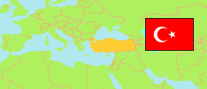
Turkey: Erzincan
Districts
The population of the districts in the Province of Erzincan.
| Name | Status | Population Estimate 2009-12-31 | Population Estimate 2013-12-31 | Population Estimate 2017-12-31 | Population Estimate 2022-12-31 | |
|---|---|---|---|---|---|---|
| Çayırlı | District | 9,925 | 9,717 | 8,710 | 8,112 | → |
| İliç | District | 6,159 | 7,367 | 7,762 | 8,905 | → |
| Kemah | District | 6,526 | 7,302 | 6,864 | 7,363 | → |
| Kemaliye | District | 5,340 | 5,044 | 4,946 | 5,170 | → |
| Merkez | District | 137,569 | 146,893 | 159,589 | 166,181 | → |
| Otlukbeli | District | 2,633 | 2,533 | 2,545 | 2,492 | → |
| Refahiye | District | 10,453 | 10,988 | 10,625 | 11,269 | → |
| Tercan | District | 18,723 | 18,549 | 17,107 | 15,653 | → |
| Üzümlü | District | 15,960 | 11,603 | 13,363 | 14,078 | → |
| Erzincan | Province | 213,288 | 219,996 | 231,511 | 239,223 |
Contents: Cities, Towns and Villages
All cities, towns and villages in the Province of Erzincan with 750 inhabitants or more.
| Name | Status | District | Population Estimate 2009-12-31 | Population Estimate 2013-12-31 | Population Estimate 2017-12-31 | Population Estimate 2022-12-31 | |
|---|---|---|---|---|---|---|---|
| Akyazı | Town | Merkez | ... | ... | ... | 1,769 | → |
| Altınbaşak | Town | Üzümlü | ... | 1,502 | 1,780 | 2,016 | → |
| Bayırbağ | Village | Üzümlü | ... | ... | 1,236 | 1,406 | → |
| Çadırkaya | Town | Tercan | 2,026 | 1,861 | 2,070 | 1,978 | → |
| Çağlayan | Town | Merkez | 1,830 | 1,813 | 2,063 | 1,942 | → |
| Çayırlı | City | Çayırlı | 3,089 | 3,441 | 5,333 | 4,644 | → |
| Çukurkuyu | Town | Merkez | 3,649 | 3,441 | 3,630 | 3,685 | → |
| Erzincan (incl. Demirkent, Geçit, Kavakyolu, Ulalar) | City | Merkez | 105,051 | 115,478 | 126,400 | 135,682 | → |
| Gümüştarla | Village | Merkez | 441 | 1,043 | 1,518 | 1,996 | → |
| İliç | City | İliç | 2,440 | 3,308 | 3,776 | 4,713 | → |
| Kargın (Altunkent) | Town | Tercan | 2,311 | 2,200 | 1,970 | 2,019 | → |
| Kemah | City | Kemah | ... | ... | ... | 2,929 | → |
| Kemaliye | City | Kemaliye | 2,240 | 2,127 | 2,245 | 2,536 | → |
| Mercan | Town | Tercan | 2,620 | 2,164 | 2,194 | 2,049 | → |
| Mollaköy | Town | Merkez | 1,929 | 1,749 | 2,080 | 1,487 | → |
| Otlukbeli | City | Otlukbeli | 1,630 | 1,555 | 1,872 | 1,956 | → |
| Refahiye | City | Refahiye | ... | ... | ... | 4,225 | → |
| Tercan | City | Tercan | 5,416 | 5,555 | 5,608 | 4,699 | → |
| Üzümlü | City | Üzümlü | ... | ... | 8,202 | 8,524 | → |
| Yalnızbağ | Town | Merkez | 2,028 | 2,513 | ... | 5,269 | → |
| Yoğurtlu | Town | Merkez | 2,818 | 3,511 | 3,356 | 3,488 | → |
Source: State Institute of Statistics, Republic of Türkiye.
Explanation: Since 2013, the population figures of cities in metropolitan provinces are calculated by using the population of selected neighborhoods.