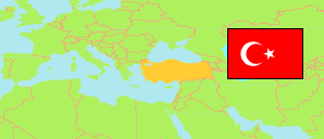
Turkey: Çankırı
Districts
The population of the districts in the Province of Çankırı.
| Name | Status | Population Estimate 2009-12-31 | Population Estimate 2013-12-31 | Population Estimate 2017-12-31 | Population Estimate 2022-12-31 | |
|---|---|---|---|---|---|---|
| Atkaracalar | District | 5,670 | 5,790 | 5,323 | 4,560 | → |
| Bayramören | District | 2,640 | 2,816 | 2,126 | 2,459 | → |
| Çerkeş | District | 16,210 | 16,255 | 16,131 | 16,526 | → |
| Eldivan | District | 5,510 | 6,607 | 5,467 | 6,163 | → |
| Ilgaz | District | 13,770 | 14,273 | 13,384 | 13,821 | → |
| Kızılırmak | District | 8,666 | 7,965 | 7,119 | 6,986 | → |
| Korgun | District | 3,929 | 4,134 | 4,034 | 4,276 | → |
| Kurşunlu | District | 9,475 | 8,878 | 7,955 | 8,484 | → |
| Merkez | District | 80,431 | 85,073 | 95,444 | 100,596 | → |
| Orta | District | 17,078 | 19,588 | 10,832 | 12,614 | → |
| Şabanözü | District | 11,651 | 10,891 | 10,683 | 11,745 | → |
| Yapraklı | District | 9,989 | 8,639 | 7,576 | 7,536 | → |
| Çankırı | Province | 185,019 | 190,909 | 186,074 | 195,766 |
Contents: Cities, Towns and Villages
All cities, towns and villages in the Province of Çankırı with 750 inhabitants or more.
| Name | Status | District | Population Estimate 2009-12-31 | Population Estimate 2013-12-31 | Population Estimate 2017-12-31 | Population Estimate 2022-12-31 | |
|---|---|---|---|---|---|---|---|
| Atkaracalar | City | Atkaracalar | 2,730 | 2,655 | 2,431 | 2,007 | → |
| Çankırı | City | Merkez | 69,087 | 74,442 | 86,369 | 91,383 | → |
| Çardaklı | Town | Atkaracalar | 2,282 | 1,930 | ... | 1,452 | → |
| Çerkeş | City | Çerkeş | 9,404 | 8,460 | 9,263 | 9,427 | → |
| Dodurga | City | Orta | ... | ... | ... | 2,019 | → |
| Eldivan | City | Eldivan | 3,034 | 3,215 | 2,846 | 3,456 | → |
| Gümerdiğin | Town | Şabanözü | ... | 1,205 | 1,120 | 1,095 | → |
| Ilgaz | City | Ilgaz | 7,738 | 7,571 | 7,795 | 7,796 | → |
| Kalfat | Village | Orta | ... | ... | 687 | 1,424 | → |
| Kızılırmak | City | Kızılırmak | 2,293 | 2,127 | 2,359 | 2,384 | → |
| Korgun | City | Korgun | 2,129 | 1,981 | 2,149 | 2,370 | → |
| Kurşunlu | City | Kurşunlu | 3,939 | 4,601 | 4,955 | 5,090 | → |
| Orta | City | Orta | 3,815 | 3,429 | ... | 3,119 | → |
| Şabanözü | City | Şabanözü | 5,124 | 5,989 | 6,359 | 7,185 | → |
| Saçak | Town | Çerkeş | ... | ... | 1,542 | 1,296 | → |
| Ünür | Village | Merkez | 1,196 | 1,079 | 956 | 785 | → |
| Yapraklı | City | Yapraklı | 1,771 | 2,130 | 2,056 | 1,797 | → |
| Yaylakent | Town | Orta | ... | ... | 2,481 | 2,579 | → |
| Yukarıöz | Village | Yapraklı | 1,399 | ... | 1,211 | 1,065 | → |
Source: State Institute of Statistics, Republic of Türkiye.
Explanation: Since 2013, the population figures of cities in metropolitan provinces are calculated by using the population of selected neighborhoods.