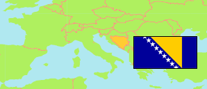
Bosnia and Herzegovina: Bosnian-Podrinje Canton
Municipalities
All municipalities of the Bosnia-Podrinje Canton (Bosansko-Podrinjski) by census years by census years.
| Name | Status | Population Census 1991-03-31 | Population Census 2013-10-01 | |
|---|---|---|---|---|
| Foča-Ustikolina | Municipality | 5,056 | 1,933 | → |
| Goražde | City | 33,105 | 20,897 | → |
| Pale-Prača | Municipality | 2,044 | 904 | → |
| Bosansko-Podrinjski [Bosnian-Podrinje] | Canton | 40,205 | 23,734 |
Contents: Settlements
All settlements in the Bosnia-Podrinje Canton (Bosansko-Podrinjski) with 200 inhabitants or more by census years.
| Name | Status | Municipality | Population Census 1991-03-31 | Population Census 2013-10-01 | |
|---|---|---|---|---|---|
| Bačci | Settlement | Goražde | 1,421 | 1,120 | → |
| Bogušići | Settlement | Goražde | 295 | 244 | → |
| Budići | Settlement | Goražde | 388 | 324 | → |
| Čovčići | Settlement | Goražde | 356 | 250 | → |
| Cvilin | Settlement | Foča-Ustikolina | ... | 230 | → |
| Dučići | Settlement | Goražde | 277 | 273 | → |
| Goražde | Urban Settlement | Goražde | 16,273 | 11,806 | → |
| Grabovik | Settlement | Goražde | 284 | 239 | → |
| Mravinjac | Settlement | Goražde | 387 | 249 | → |
| Potrkuša | Settlement | Goražde | 144 | 237 | → |
| Prača | Settlement | Pale-Prača | ... | 304 | → |
| Sedlari | Settlement | Goražde | 391 | 211 | → |
| Ustikolina | Settlement | Foča-Ustikolina | 1,418 | 882 | → |
| Vitkovići | Settlement | Goražde | 1,080 | 942 | → |
| Zebina Šuma | Settlement | Foča-Ustikolina | 430 | 257 | → |
| Zupčići | Settlement | Goražde | 792 | 382 | → |
Source: Bosnia and Herzegovina Agency for Statistics (web).