United Kingdom
United Kingdom of Great Britain and Northern Ireland
Content
Kingdom
-

News
On 1 April 2023, the counties of Somerset and North Yorkshire became unitary authorities. The districts of Allerdale, Carlisle and Copeland are merged to form Cumberland, and the districts of Barrow-in-Furness, Eden and South Lakeland formed Westmorland and Furness unitary authority.
2024-07-25
The new 2022 definition of built-up areas results in 5,406 settlements having 500 inhabitants or more (based on 2021 output area population). In comparison to the 2011 definition, some areas became smaller by separating new built-up areas (e.g. Kingswood/Fishponds from Bristol).
2023-03-17
According to the 2020 definition of Scottish localities and settlements, 6 new localities are listed: Aberuthven, Bannerfield, Burnfoot, Countesswells, Langlee, and South Forres.
2022-11-11
According to first results of the 2021 population census, England has 56.49 million, Wales 3.11 million and Northern Ireland 1.903 million inhabitants.
2022-07-06
Shipley, Kingsthorpe, Far Cotton and Delapre, Heybridge Basin, Harlestone Manor and Hunts Grove are new parishes. Fawcett Forest parish and Whitwell and Selside parish are fused to Selside and Fawcett Forest. Eastcotts parish is split into Shortstown and Cotton End.
2021-10-08
Since April 2021, the previous districts Daventry, Northampton and South Northamptonshire form the new unitary district West Northamptonshire. Corby, East Northamptonshire, Kettering and Wellingborough are merged to North Northamptonshire at the same time.
2021-06-30
Since April 2020, the former districts Aylesbury Vale, Chiltern, South Bucks and Wycombe form the new unitary authority Buckinghamshire.
2020-06-27
The 2018 boundary and population update of England and Wales considers of several changes of wards. Furthermore, there are three new civil parishes: Bestwood Village and St. Albans (by split of Bestwood St. Albans) as well as the City of Durham. Shepway district is renamed as Folkestone and Hythe.
2019-10-26
Mergers on district level: Forest Heath and St Edmundsbury merged to West Suffolk, Suffolk Coastal and Waveney to East Suffolk, and Taunton Deane and West Somerset to Somerset West and Taunton. Bournemouth, Christchurch and Poole as well as the rest of Dorset county form two unitary districts.
2019-06-30
-
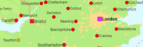
Major Cities
The countries of the UK as well as all cities and towns with a population of more than 50,000.
1991, 2001, 2011 census, 2021 census/estimate
-
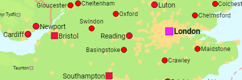
Major Urban Areas
The countries of the UK as well as all urban areas with a population of more than 50,000.
1991, 2001, 2011 census, 2021 census/estimate
-
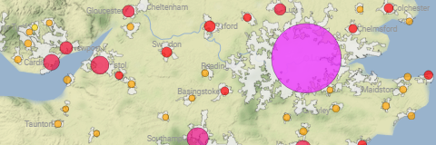
Agglomerations
All agglomerations in the UK with a population of more than 45,000.
2001, 2011 census, 2021 census/estimate
-
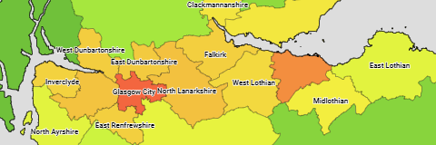
Administrative Division
The population of all UK counties, council areas, districts and metropolitan boroughs.
1981, 1991, 2001, 2011, 2021, 2023 estimate
-

England
-
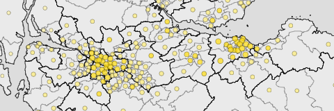
Major Cities, Counties & Districts
Counties and unitary districts as well as all cities and towns (i.e. built-up areas or their subdivisions) with more than 20,000 inhabitants.
2001, 2011, 2021 census – 2022 boundaries
-
Urban Areas
All English urban areas (i.e. more or less continuously built-up areas) with more than 20,000 inhabitants.
2001, 2011, 2021 census
Regions:
- Settlements – counties, unitary districts & built-up areas with a population of 500 or more – 2001, 2011, 2021 census – 2022 boundaries
- Wards – local authority districts & wards – 2001, 2011, 2021 census – 2022 boundaries
- Civil Parishes – local authority districts & civil parishes – 2001, 2011, 2021 census – 2022 boundaries
- Districts – districts & boroughs – 1991, 2001, 2011, 2021 census
-
East Midlands
-
East of England
-
London
-
North East England
-
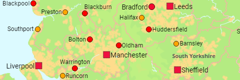
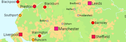
North West England
-
South East England
-
South West England
-
West Midlands
-
Yorkshire and the Humber
Metropolitan Counties: Boroughs
1981, 1991, 2001, 2011, 2021, 2023 estimate
Northern Ireland
-
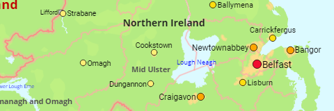
Major Cities & Districts
The local government districts and all cities and settlements with a population of more than 2,500.
1981, 1991, 2001, 2011, 2021 census
-
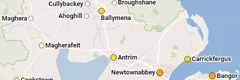
Settlements
The population of all settlements with a population of more than 50.
1981, 1991, 2001, 2011 census
-
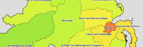
Districts
The population of the local government districts of Northern Ireland.
1991, 2001, 2011, 2021 estimate
-

District Electoral Areas
The population of the local government districts and district electoral areas of Northern Ireland.
2001, 2011, 2021 census
-
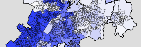
Belfast Agglomeration
The population of the data zones of Belfast.
2021 census
Scotland
-
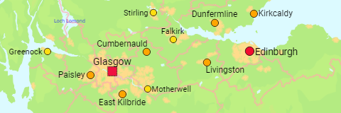
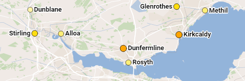
Major Cities & Council Areas
The council areas as well as all cities and towns ("localities") having a population of more than 15,000.
1991, 2001, 2011, 2022 census – 2022 boundaries
-
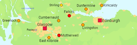
Urban Areas
All urban areas ("settlements") in Scotland that have a population of more than 15,000.
1991, 2001, 2011, 2022 census – 2022 boundaries
-
Localities
The population of all localities having a population of more than 500.
2001, 2011, 2022 census – 2022 boundaries
-
Council Areas
The population of the council areas of Scotland.
1981, 1991, 2001, 2011, 2021, 2023 estimate
-
Electoral Wards
The population of the council areas and electoral wards of Scotland.
2001, 2011, 2022 census
Wales
-
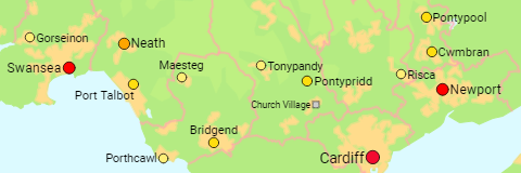
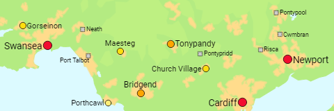
Major Cities & Districts
The districts as well as all cities and towns (i.e. built-up areas or their subdivisions) with 15,000 inhabitants or more.
2001, 2011, 2021 census – 2022 boundaries
-
Urban Areas
All Welsh urban areas (i.e. more or less continuously built-up areas) of more than 15,000 inhabitants.
2001, 2011, 2021 census – 2022 boundaries
-
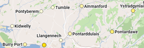
Settlements
The population of all built-up areas with 500 inhabitants or more.
2001, 2011, 2021 census – 2022 boundaries
-
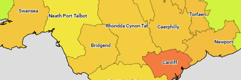
Districts
The population of the Welsh districts.
1981, 1991, 2001, 2011, 2021, 2023 estimate
-
Wards
The population of the districts and wards of Wales.
2001, 2011, 2021 census – 2022 boundaries
-
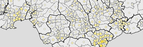
Communities
The population of the districts and communities of Wales.
2001, 2011, 2021 census