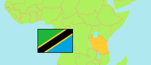
Mwanga
District in Northern Tanzania
Contents: Subdivision
The population in Mwanga as well as related information and services (Wikipedia, Google, images).
| Name | Status | Population Census 2022-08-23 | |
|---|---|---|---|
| Mwanga | District | 148,763 | |
| Chomvu | Rural Ward | 7,352 | → |
| Jipe | Rural Ward | 3,222 | → |
| Kifula | Rural Ward | 7,827 | → |
| Kighare | Rural Ward | 5,155 | → |
| Kigonigoni (Kigoningoni) | Rural Ward | 3,325 | → |
| Kileo | Mixed Ward | 17,784 | → |
| Kilomeni | Rural Ward | 3,909 | → |
| Kirongwe | Rural Ward | 4,559 | → |
| Kirya | Mixed Ward | 5,808 | → |
| Kivisini | Rural Ward | 2,106 | → |
| Kwakoa | Rural Ward | 4,359 | → |
| Lang'ata | Mixed Ward | 9,830 | → |
| Lembeni | Rural Ward | 13,601 | → |
| Mgagao | Rural Ward | 8,904 | → |
| Msangeni | Rural Ward | 6,661 | → |
| Mwanga | Mixed Ward | 23,195 | → |
| Mwaniko | Rural Ward | 7,272 | → |
| Ngujini | Rural Ward | 2,974 | → |
| Shighatini | Rural Ward | 7,016 | → |
| Toloha | Rural Ward | 3,904 | → |
| Northern | Zone | 8,726,288 |
Source: National Bureau of Statistics Tanzania.
Explanation: Area figures are derived from geospatial data.