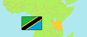
Nanyumbu
District in Coastal Tanzania
Contents: Subdivision
The population in Nanyumbu as well as related information and services (Wikipedia, Google, images).
| Name | Status | Population Census 2022-08-23 | |
|---|---|---|---|
| Nanyumbu | District | 204,323 | |
| Chipuputa | Rural Ward | 12,469 | → |
| Kamundi | Rural Ward | 9,296 | → |
| Kilimanihewa | Mixed Ward | 12,927 | → |
| Likokona | Mixed Ward | 14,707 | → |
| Lumesule | Rural Ward | 14,450 | → |
| Mangaka | Mixed Ward | 12,776 | → |
| Maratani | Rural Ward | 7,692 | → |
| Masuguru | Rural Ward | 8,787 | → |
| Michiga | Mixed Ward | 13,665 | → |
| Mikangaula | Rural Ward | 9,892 | → |
| Mkonona | Rural Ward | 9,577 | → |
| Mnanje | Rural Ward | 8,476 | → |
| Nandete | Rural Ward | 11,785 | → |
| Nangomba | Rural Ward | 9,785 | → |
| Nanyumbu | Rural Ward | 13,654 | → |
| Napacho | Rural Ward | 13,759 | → |
| Sengenya | Rural Ward | 20,626 | → |
| Coastal | Zone | 13,434,754 |
Source: National Bureau of Statistics Tanzania.
Explanation: Area figures are derived from geospatial data.