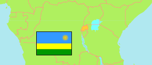
Nord
Province in Rwanda
Contents: Subdivision
The population development in Nord as well as related information and services (Wikipedia, Google, images).
| Name | Status | Population Census 2002-08-16 | Population Census 2012-08-15 | Population Census 2022-08-15 | |
|---|---|---|---|---|---|
| Nord (Intara y'Amajyaruguru) [Northern] | Province | 1,560,862 | 1,726,370 | 2,038,511 | |
| Burera | District | 320,759 | 336,582 | 387,729 | → |
| Gakenke | District | 322,043 | 338,234 | 365,292 | → |
| Gicumbi | District | 359,716 | 395,606 | 448,824 | → |
| Musanze | District | 307,078 | 368,267 | 476,522 | → |
| Rulindo | District | 251,266 | 287,681 | 360,144 | → |
| Rwanda | Republic | 8,128,553 | 10,515,973 | 13,246,394 |
Source: National Institute of Statistics Rwanda.
Further information about the population structure:
| Gender (C 2022) | |
|---|---|
| Males | 972,960 |
| Females | 1,065,551 |
| Age Groups (C 2022) | |
|---|---|
| 0-14 years | 739,748 |
| 15-64 years | 1,200,062 |
| 65+ years | 98,701 |
| Age Distribution (C 2022) | |
|---|---|
| 80+ years | 21,844 |
| 70-79 years | 40,226 |
| 60-69 years | 86,784 |
| 50-59 years | 109,944 |
| 40-49 years | 180,392 |
| 30-39 years | 277,964 |
| 20-29 years | 340,717 |
| 10-19 years | 470,301 |
| 0-9 years | 510,339 |
| Urbanization (C 2022) | |
|---|---|
| Rural | 1,684,782 |
| Urban | 353,729 |
| Citizenship (C 2022) | |
|---|---|
| Rwanda | 2,036,204 |
| Foreign Citizenship | 2,307 |
| Literacy (A15+) (C 2022) | |
|---|---|
| yes | 1,002,600 |
| no | 296,100 |