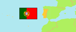
Santo Tirso
Municipality in Porto District
Contents: Subdivision
The population development in Santo Tirso as well as related information and services (Wikipedia, Google, images).
| Name | Status | Population Census 2001-03-12 | Population Census 2011-03-21 | Population Census 2021-03-22 | |
|---|---|---|---|---|---|
| Santo Tirso | Municipality | 72,396 | 71,530 | 67,709 | |
| Agrela | Parish | 1,604 | 1,584 | 1,486 | → |
| Água Longa | Parish | 2,134 | 2,207 | 2,341 | → |
| Areias, Sequeiró, Lama e Palmeira | Parish | 6,987 | 6,795 | 6,369 | → |
| Aves | Parish | 8,492 | 8,458 | 7,946 | → |
| Carreira e Refojos de Riba de Ave | Parish | 2,088 | 2,072 | 2,040 | → |
| Lamelas e Guimarei | Parish | 1,689 | 1,660 | 1,567 | → |
| Monte Córdova | Parish | 3,669 | 3,958 | 3,848 | → |
| Negrelos (São Tomé) (São Tomé de Negrelos) | Parish | 4,241 | 4,032 | 3,755 | → |
| Rebordões | Parish | 3,559 | 3,368 | 3,130 | → |
| Reguenga | Parish | 1,595 | 1,596 | 1,427 | → |
| Roriz | Parish | 3,724 | 3,665 | 3,308 | → |
| Santo Tirso, Couto (Santa Cristina e São Miguel) e Burgães | Parish | 21,420 | 21,538 | 20,590 | → |
| Vila Nova do Campo | Parish | 7,158 | 6,809 | 6,315 | → |
| Vilarinho | Parish | 4,036 | 3,788 | 3,587 | → |
| Porto | District | 1,781,836 | 1,817,175 | 1,785,405 |
Source: Instituto Nacional de Estatística Portugal (web).
Further information about the population structure:
| Gender (C 2021) | |
|---|---|
| Males | 32,241 |
| Females | 35,468 |
| Age Groups (C 2021) | |
|---|---|
| 0-14 years | 7,345 |
| 15-64 years | 43,696 |
| 65+ years | 16,668 |
| Age Distribution (C 2021) | |
|---|---|
| 80+ years | 4,441 |
| 70-79 years | 7,256 |
| 60-69 years | 10,046 |
| 50-59 years | 10,818 |
| 40-49 years | 9,890 |
| 30-39 years | 7,378 |
| 20-29 years | 7,277 |
| 10-19 years | 5,951 |
| 0-9 years | 4,652 |
| Citizenship (C 2021) | |
|---|---|
| Portugal | 66,666 |
| EU | 200 |
| Europe (other) | 87 |
| Africa | 122 |
| America | 546 |
| Asia & Oceania | 88 |
| Country of Birth (C 2021) | |
|---|---|
| Portugal | 64,474 |
| EU | 1,219 |
| Europe (other) | 235 |
| Africa | 674 |
| America | 998 |
| Asia & Oceania | 109 |