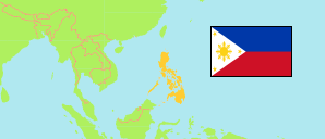
Cordillera
Region in Philippines
Contents: Subdivision
The population development in Cordillera as well as related information and services (Wikipedia, Google, images).
| Name | Status | Population Census 1990-05-01 | Population Census 2000-05-01 | Population Census 2010-05-01 | Population Census 2015-08-01 | Population Census 2020-05-01 | Population Census 2024-07-01 | |
|---|---|---|---|---|---|---|---|---|
| Cordillera (Cordillera Administrative Region) | Region | 1,146,191 | 1,365,412 | 1,616,867 | 1,722,006 | 1,797,660 | 1,808,985 | |
| Abra | Province | 184,743 | 209,491 | 234,733 | 241,160 | 250,985 | 246,948 | → |
| Apayao | Province | 74,720 | 97,129 | 112,636 | 119,184 | 124,366 | 126,587 | → |
| Benguet (incl. Baguio City) | Province | 485,857 | 582,515 | 722,620 | 791,590 | 827,041 | 841,616 | → |
| Ifugao | Province | 147,281 | 161,623 | 191,078 | 202,802 | 207,498 | 208,668 | → |
| Kalinga | Province | 137,055 | 174,023 | 201,613 | 212,680 | 229,570 | 235,391 | → |
| Mountain Province | Province | 116,535 | 140,631 | 154,187 | 154,590 | 158,200 | 149,775 | → |
| Pilipinas [Philippines] | Republic | 60,703,810 | 76,506,928 | 92,337,852 | 100,981,437 | 109,035,343 | 112,729,484 |
Source: Philippines Statistics Authority.
Explanation: Area figures are calculated by using geospatial data.
Further information about the population structure:
| Gender (C 2020) | |
|---|---|
| Males | 917,431 |
| Females | 873,690 |
| Age Groups (C 2020) | |
|---|---|
| 0-14 years | 505,157 |
| 15-64 years | 1,178,144 |
| 65+ years | 107,820 |
| Age Distribution (C 2020) | |
|---|---|
| 80+ years | 21,406 |
| 70-79 years | 43,930 |
| 60-69 years | 101,342 |
| 50-59 years | 152,907 |
| 40-49 years | 192,970 |
| 30-39 years | 261,851 |
| 20-29 years | 333,256 |
| 10-19 years | 354,047 |
| 0-9 years | 329,412 |