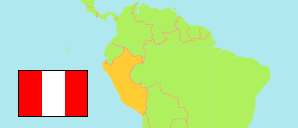
Amazonas
Region in Peru
Contents: Subdivision
The population development in Amazonas as well as related information and services (Wikipedia, Google, images).
| Name | Status | Population Census 1993-07-11 | Population Census 2007-10-21 | Population Census 2017-10-22 | Population Projection 2022-06-30 | |
|---|---|---|---|---|---|---|
| Amazonas | Region | 336,665 | 375,993 | 417,365 | 429,483 | |
| Bagua | Province | 69,482 | 71,757 | 82,193 | 85,835 | → |
| Bongará | Province | 20,459 | 27,465 | 27,085 | 26,449 | → |
| Chachapoyas | Province | 45,058 | 49,700 | 60,419 | 64,058 | → |
| Condorcanqui | Province | 30,520 | 43,311 | 49,800 | 52,082 | → |
| Luya | Province | 46,837 | 48,328 | 48,140 | 47,081 | → |
| Rodríguez de Mendoza | Province | 21,389 | 26,389 | 32,130 | 34,099 | → |
| Utcubamba | Province | 102,920 | 109,043 | 117,598 | 119,879 | → |
| Peru | Republic | 22,639,443 | 27,219,264 | 31,237,385 | 33,396,698 |
Source: Instituto Nacional de Estadística e Informática, Peru (web).
Explanation: The tabulated results of the 2017 census are adjusted for underenumeration. Area figures of provinces are computed by using geospatial data.
Further information about the population structure:
| Gender (C 2017) | |
|---|---|
| Males | 211,439 |
| Females | 205,926 |
| Age Groups (C 2017) | |
|---|---|
| 0-14 years | 136,112 |
| 15-64 years | 251,682 |
| 65+ years | 29,571 |
| Age Distribution (C 2017) | |
|---|---|
| 90+ years | 1,058 |
| 80-89 years | 5,993 |
| 70-79 years | 13,147 |
| 60-69 years | 21,970 |
| 50-59 years | 34,465 |
| 40-49 years | 47,480 |
| 30-39 years | 58,809 |
| 20-29 years | 61,841 |
| 10-19 years | 81,501 |
| 0-9 years | 91,103 |
| Urbanization (C 2017) | |
|---|---|
| Rural | 248,020 |
| Urban | 169,345 |
| Literacy (A3+) (C 2017) | |
|---|---|
| yes | 326,784 |
| no | 65,235 |
| Ethnic Group (A12+) (C 2017) | |
|---|---|
| Quechua | 8,830 |
| Aymara | 187 |
| Afro-Peruvian | 10,282 |
| White | 13,509 |
| Mestizo | 219,375 |
| Other group | 42,868 |
| Religion (A12+) (C 2017) | |
|---|---|
| Catholics | 194,677 |
| Evangelicals | 72,157 |
| Other religion | 15,647 |
| No religion | 25,554 |