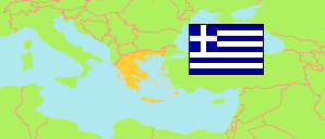
Stereá Elláda
Region in Greece
Contents: Subdivision
The population development in Stereá Elláda as well as related information and services (Wikipedia, Google, images).
| Name | Status | Native | Population Census 1991-03-17 | Population Census 2001-03-18 | Population Census 2011-03-16 | Population Census 2021-10-22 | |
|---|---|---|---|---|---|---|---|
| Stereá Elláda [Central Greece] | Region | Στερεά Ελλάδα | 548,101 | 558,144 | 547,390 | 508,255 | |
| Perifereiakí Enótita Evrytanías [Evrytania] | Regional Unit | Περιφερειακή ενότητα Ευρυτανίας | 20,390 | 19,518 | 20,081 | 17,428 | → |
| Perifereiakí Enótita Evvoías [Euboea] | Regional Unit | Περιφερειακή ενότητα Ευβοίας | 202,131 | 207,305 | 210,815 | 210,776 | → |
| Perifereiakí Enótita Fokídas [Phocis] | Regional Unit | Περιφερειακή ενότητα Φωκίδας | 36,766 | 37,866 | 40,343 | 36,196 | → |
| Perifereiakí Enótita Fthiótidas [Phthiotis] | Regional Unit | Περιφερειακή ενότητα Φθιώτιδας | 163,395 | 169,542 | 158,231 | 137,794 | → |
| Perifereiakí Enótita Voiotías [Boeotia] | Regional Unit | Περιφερειακή ενότητα Βοιωτίας | 125,419 | 123,913 | 117,920 | 106,055 | → |
| Elláda [Greece] | Republic | Ελλάδα | 10,223,392 | 10,934,097 | 10,816,286 | 10,482,487 |
Source: General Secretariat of National Statistical Service of Greece.
Further information about the population structure:
| Gender (C 2021) | |
|---|---|
| Males | 254,511 |
| Females | 253,741 |
| Age Groups (C 2021) | |
|---|---|
| 0-14 years | 66,286 |
| 15-59 years | 311,484 |
| 65+ years | 130,482 |
| Age Distribution (C 2021) | |
|---|---|
| 90+ years | 7,762 |
| 80-89 years | 36,283 |
| 70-79 years | 53,581 |
| 60-69 years | 69,083 |
| 50-59 years | 75,891 |
| 40-49 years | 74,053 |
| 30-39 years | 56,864 |
| 20-29 years | 44,735 |
| 10-19 years | 49,047 |
| 0-9 years | 40,970 |
| Urbanization (C 2021) | |
|---|---|
| Rural | 200,166 |
| Urban | 308,090 |
| Citizenship (C 2021) | |
|---|---|
| Greece | 470,640 |
| EU | 4,590 |
| Europe (rest) | 22,084 |
| Asia | 9,287 |
| Other Citizenship | 1,644 |
| Place of Birth (C 2021) | |
|---|---|
| Same municipality | 344,731 |
| Other municipality in same region | 33,234 |
| Other region | 87,770 |
| Other country | 42,517 |