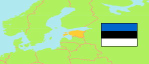
Lääne (Estonia)
County
The population development of Lääne.
| Name | Status | Population Census 2011-12-31 | Population Census 2021-12-31 | |
|---|---|---|---|---|
| Lääne | County | 20,506 | 20,229 | → |
| Eesti [Estonia] | Republic | 1,294,455 | 1,331,824 |
Contents: Settlements
The population development of the settlements in Lääne.
| Name | Status | County | Population Census 2011-12-31 | Population Census 2021-12-31 | |
|---|---|---|---|---|---|
| Haapsalu | Built-up Area | Lääne | 11,591 | 11,067 | → |
| Herjava | Built-up Area | Lääne | ... | 230 | → |
| Jõõdre | Built-up Area | Lääne | 222 | 230 | → |
| Koluvere | Built-up Area | Lääne | 243 | ... | → |
| Kullamaa | Built-up Area | Lääne | 224 | 201 | → |
| Linnamäe | Built-up Area | Lääne | 353 | 378 | → |
| Palivere - Luigu | Built-up Area | Lääne | 686 | 707 | → |
| Panga | Built-up Area | Lääne | 254 | 247 | → |
| Risti | Built-up Area | Lääne | 557 | 581 | → |
| Taebla - Kadarpiku | Built-up Area | Lääne | 861 | 901 | → |
Source: Statistical Office of Estonia (web).
Explanation: Settlements are defined by built-up areas where the distance between buildings is no more than 200 meters and where live at least 200 persons. Area figures and boundary refer to the 2011 definition.