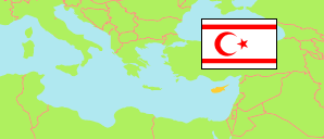
Güzelyurt (Cyprus)
Municipality
The population development of Güzelyurt.
| Name | Status | Population Census 2006-04-30 | Population Census 2011-12-04 | |
|---|---|---|---|---|
| Güzelyurt (Mórfou) [Morphou] | Municipality | 18,562 | 18,946 | → |
| Kuzey Kıbrıs [Northern Cyprus] | Turkish Republic | 256,644 | 286,257 |
Contents: Towns and Villages
The population development of the towns and villages in Güzelyurt.
| Name | Status | Municipality | Population Census 2006-04-30 | Population Census 2011-12-04 | |
|---|---|---|---|---|---|
| Akçay (Argáki) | Village | Güzelyurt | 1,033 | 1,008 | → |
| Aşağı Bostancı (Káto Zódia) | Village | Güzelyurt | 2,024 | 1,822 | → |
| Aydınköy (Prastió) | Village | Güzelyurt | 1,154 | 1,164 | → |
| Gayretköy (Avlóna) | Village | Güzelyurt | 367 | 367 | → |
| Güneşköy (Nikítas) | Village | Güzelyurt | 546 | 505 | → |
| Güzelyurt (Mórfou) [Morphou] | Town | Güzelyurt | 7,627 | 7,251 | → |
| Kalkanlı (Kaló Chorió Kapoúti) | Village | Güzelyurt | 1,338 | 2,305 | → |
| Mevlevi (Kyrá) | Village | Güzelyurt | 370 | 386 | → |
| Şahinler (Másari) | Village | Güzelyurt | 179 | 189 | → |
| Serhatköy (Filiá) | Village | Güzelyurt | 595 | 573 | → |
| Yayla (Syrianochóri) | Village | Güzelyurt | 775 | 850 | → |
| Yukarı Bostancı (Páno Zódia) | Village | Güzelyurt | 1,419 | 1,495 | → |
| Yuvacık (Chrysilioú) | Village | Güzelyurt | 214 | 214 | → |
| Zümrütköy (Katokopiá) | Village | Güzelyurt | 921 | 817 | → |
Source: TRNC Statistical Institute.
Explanation: Area and density figures are computed from geospatial data clipped at the northern border of the UN buffer zone.