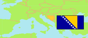
Gornja Dragotinja
in Prijedor (Serb Republic)
Contents: Settlement
The population development of Gornja Dragotinja as well as related information and services (weather, Wikipedia, Google, images).
| Name | Native | Municipality | Population Census 1991-03-31 | Population Census 2013-10-01 | |
|---|---|---|---|---|---|
| Gornja Dragotinja | Горња Драготиња | Prijedor | 520 | 305 | → |
Source: Republika Srpska Institute of Statistics (web). Ethnic groups: Bosnia and Herzegovina Agency for Statistics (web).
Explanation: In case of the 2013 figures, the usually resident population is tabulated. In contrast, the ethnic group figures include also citizens of Bosnia and Herzegovina living and working abroad for many years.
Further information about the population structure:
| Gender (C 2013) | |
|---|---|
| Males | 151 |
| Females | 154 |
| Age Groups (C 2013) | |
|---|---|
| 0-14 years | 27 |
| 15-64 years | 184 |
| 65+ years | 94 |
| Age Distribution (C 2013) | |
|---|---|
| 0-9 years | 16 |
| 10-19 years | 24 |
| 20-29 years | 24 |
| 30-39 years | 27 |
| 40-49 years | 49 |
| 50-59 years | 48 |
| 60-69 years | 40 |
| 70-79 years | 59 |
| 80+ years | 18 |
| Ethnic Group (C 2013) | |
|---|---|
| Serbs | 302 |
| Croats | 1 |
| Other group | 5 |