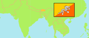
Wangdue Phodrang
District in Bhutan
Contents: Subdivision
The population development in Wangdue Phodrang as well as related information and services (Wikipedia, Google, images).
| Name | Status | Population Census 2005-05-31 | Population Census 2017-05-30 | |
|---|---|---|---|---|
| Wangdue Phodrang | District | 31,120 | 42,186 | |
| Athang | Gewog | 808 | 773 | → |
| Bjenag (Bjena, Bjendag) | Gewog | 2,110 | 1,916 | → |
| Dangchhu (Dangchu) | Gewog | 1,772 | 1,815 | → |
| Darkar (Daga) | Gewog | 1,682 | 6,270 | → |
| Gangteng (Gangte) | Gewog | 1,677 | 2,775 | → |
| Gase Tshogongm (Gasetsho Gom) | Gewog | 2,241 | 3,960 | → |
| Gase Tshowogm (Gasetsho Om) | Gewog | 722 | 959 | → |
| Kazhi | Gewog | 1,284 | 1,289 | → |
| Nahi | Gewog | 823 | 596 | → |
| Nyishog (Nyisho) | Gewog | 2,304 | 2,512 | → |
| Phangyuel | Gewog | 1,127 | 964 | → |
| Phobji | Gewog | 1,929 | 2,121 | → |
| Ruebisa (Ruepisa) | Gewog | 1,709 | 2,179 | → |
| Saephu (Sephu) | Gewog | 1,996 | 1,729 | → |
| Thedtsho | Gewog | 8,936 | 12,328 | → |
| Druk Yul [Bhutan] | Kingdom | 634,982 | 727,145 |
Source: National Statistics Bureau, Royal Government of Bhutan (web).
Explanation: The population figures of towns and municipalities are generally assigned to an adjacent gewog. Area figures of gewogs are computed by using geospatial data.
Further information about the population structure:
| Gender (C 2017) | |
|---|---|
| Males | 24,302 |
| Females | 17,884 |
| Age Groups (C 2017) | |
|---|---|
| 0-14 years | 10,689 |
| 15-64 years | 29,113 |
| 65+ years | 2,384 |
| Age Distribution (C 2017) | |
|---|---|
| 0-9 years | 6,967 |
| 10-19 years | 6,959 |
| 20-29 years | 9,568 |
| 30-39 years | 7,429 |
| 40-49 years | 4,883 |
| 50-59 years | 2,982 |
| 60-69 years | 1,781 |
| 70+ years | 1,617 |
| Urbanization (C 2017) | |
|---|---|
| Rural | 32,306 |
| Urban | 9,880 |