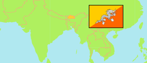
Trashigang
District in Bhutan
Contents: Subdivision
The population development in Trashigang as well as related information and services (Wikipedia, Google, images).
| Name | Status | Population Census 2005-05-31 | Population Census 2017-05-30 | |
|---|---|---|---|---|
| Trashigang | District | 48,783 | 45,518 | |
| Bartsham | Gewog | 1,807 | 1,788 | → |
| Bidoong (Bidung) | Gewog | 1,929 | 1,421 | → |
| Kanglung | Gewog | 6,466 | 7,316 | → |
| Kangpar (Kangpara) | Gewog | 2,217 | 1,591 | → |
| Khaling | Gewog | 4,395 | 3,585 | → |
| Lumang | Gewog | 5,488 | 4,293 | → |
| Merag (Merak) | Gewog | 1,621 | 1,562 | → |
| Phongmed (Phongme) | Gewog | 2,427 | 2,617 | → |
| Radhi (Radi) | Gewog | 3,303 | 2,346 | → |
| Sagteng (Sakteng) | Gewog | 2,072 | 2,061 | → |
| Samkhar | Gewog | 5,064 | 5,146 | → |
| Shongphu (Shongphoog) | Gewog | 4,096 | 3,949 | → |
| Thrimshing | Gewog | 2,435 | 2,548 | → |
| Udzorong (Uzorong) | Gewog | 3,148 | 2,760 | → |
| Yangnyer | Gewog | 2,315 | 2,535 | → |
| Druk Yul [Bhutan] | Kingdom | 634,982 | 727,145 |
Source: National Statistics Bureau, Royal Government of Bhutan (web).
Explanation: The population figures of towns and municipalities are generally assigned to an adjacent gewog. Area figures of gewogs are computed by using geospatial data.
Further information about the population structure:
| Gender (C 2017) | |
|---|---|
| Males | 23,414 |
| Females | 22,104 |
| Age Groups (C 2017) | |
|---|---|
| 0-14 years | 12,596 |
| 15-64 years | 29,560 |
| 65+ years | 3,362 |
| Age Distribution (C 2017) | |
|---|---|
| 0-9 years | 7,927 |
| 10-19 years | 9,367 |
| 20-29 years | 8,656 |
| 30-39 years | 6,167 |
| 40-49 years | 4,683 |
| 50-59 years | 3,788 |
| 60-69 years | 2,694 |
| 70+ years | 2,236 |
| Urbanization (C 2017) | |
|---|---|
| Rural | 35,410 |
| Urban | 10,108 |