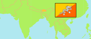
Thimphu
District in Bhutan
Contents: Subdivision
The population development in Thimphu as well as related information and services (Wikipedia, Google, images).
| Name | Status | Population Census 2005-05-31 | Population Census 2017-05-30 | |
|---|---|---|---|---|
| Thimphu | District | 94,102 | 138,736 | |
| Chang | Gewog | 3,137 | 6,752 | → |
| Darkarla (Dagala) | Gewog | 1,497 | 2,094 | → |
| Ge-nyen (Genye) | Gewog | 918 | 1,141 | → |
| Kawang | Gewog | 2,582 | 5,477 | → |
| Lingzhi | Gewog | 495 | 490 | → |
| Maedwang (Mewang) | Gewog | 5,916 | 7,799 | → |
| Naro | Gewog | 189 | 250 | → |
| Soe | Gewog | 183 | 182 | → |
| Thimphu | Municipality | 79,185 | 114,551 | → |
| Druk Yul [Bhutan] | Kingdom | 634,982 | 727,145 |
Source: National Statistics Bureau, Royal Government of Bhutan (web).
Explanation: The population figures of towns and municipalities are generally assigned to an adjacent gewog. Area figures of gewogs are computed by using geospatial data.
Further information about the population structure:
| Gender (C 2017) | |
|---|---|
| Males | 72,522 |
| Females | 66,214 |
| Age Groups (C 2017) | |
|---|---|
| 0-14 years | 32,861 |
| 15-64 years | 100,559 |
| 65+ years | 5,316 |
| Age Distribution (C 2017) | |
|---|---|
| 0-9 years | 22,243 |
| 10-19 years | 22,332 |
| 20-29 years | 38,257 |
| 30-39 years | 26,753 |
| 40-49 years | 13,861 |
| 50-59 years | 7,498 |
| 60-69 years | 4,166 |
| 70+ years | 3,626 |
| Urbanization (C 2017) | |
|---|---|
| Rural | 23,219 |
| Urban | 115,517 |