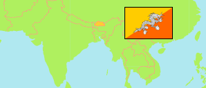
Lhuentse
District in Bhutan
Contents: Subdivision
The population development in Lhuentse as well as related information and services (Wikipedia, Google, images).
| Name | Status | Population Census 2005-05-31 | Population Census 2017-05-30 | |
|---|---|---|---|---|
| Lhuentse (Lhuntse) | District | 15,395 | 14,437 | |
| Gangzur | Gewog | 3,865 | 3,762 | → |
| Jarey (Jaray) | Gewog | 1,143 | 1,008 | → |
| Khoma | Gewog | 1,819 | 1,501 | → |
| Kurtoed (Kurtoe) | Gewog | 1,005 | 740 | → |
| Maedtsho (Metsho) | Gewog | 1,210 | 945 | → |
| Maenbi (Menbi) | Gewog | 2,528 | 2,341 | → |
| Minjey (Minjay) | Gewog | 1,382 | 1,430 | → |
| Tsaenkhar (Tsenkhar) | Gewog | 2,443 | 2,710 | → |
| Druk Yul [Bhutan] | Kingdom | 634,982 | 727,145 |
Source: National Statistics Bureau, Royal Government of Bhutan (web).
Explanation: The population figures of towns and municipalities are generally assigned to an adjacent gewog. Area figures of gewogs are computed by using geospatial data.
Further information about the population structure:
| Gender (C 2017) | |
|---|---|
| Males | 7,407 |
| Females | 7,030 |
| Age Groups (C 2017) | |
|---|---|
| 0-14 years | 4,263 |
| 15-64 years | 9,006 |
| 65+ years | 1,168 |
| Age Distribution (C 2017) | |
|---|---|
| 0-9 years | 2,635 |
| 10-19 years | 3,053 |
| 20-29 years | 2,261 |
| 30-39 years | 2,083 |
| 40-49 years | 1,492 |
| 50-59 years | 1,237 |
| 60-69 years | 877 |
| 70+ years | 799 |
| Urbanization (C 2017) | |
|---|---|
| Rural | 12,162 |
| Urban | 2,275 |