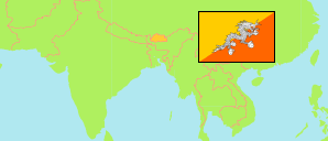
Dagana
District in Bhutan
Contents: Subdivision
The population development in Dagana as well as related information and services (Wikipedia, Google, images).
| Name | Status | Population Census 2005-05-31 | Population Census 2017-05-30 | |
|---|---|---|---|---|
| Dagana | District | 22,375 | 24,965 | |
| Dorona | Gewog | 754 | 752 | → |
| Drukjeygang (Drugyelgang, Drujegang) | Gewog | 2,673 | 2,517 | → |
| Gesarling | Gewog | 1,340 | 1,663 | → |
| Gozhi (Goshi) | Gewog | 2,187 | 2,507 | → |
| Karmaling (Deorali) [← Sarpang District] | Gewog | 1,315 | 1,324 | → |
| Karna (Kalidzingkha) | Gewog | 1,964 | 2,510 | → |
| Khebisa (Khipisa) | Gewog | 1,212 | 1,215 | → |
| Largyab (Lajab) | Gewog | 863 | 843 | → |
| Lhamoi Dzingkha (Lhamoizingkha, Lhamoy Zingkha) [← Sarpang District] | Gewog | 2,359 | 2,757 | → |
| Nichula [← Sarpang District] | Gewog | 479 | 434 | → |
| Tashiding (Trashiding) | Gewog | 1,636 | 1,687 | → |
| Tsangkha | Gewog | 1,467 | 1,707 | → |
| Tsenda-Gang (Tsendagang) | Gewog | 1,874 | 2,407 | → |
| Tseza | Gewog | 2,252 | 2,642 | → |
| Druk Yul [Bhutan] | Kingdom | 634,982 | 727,145 |
Source: National Statistics Bureau, Royal Government of Bhutan (web).
Explanation: The population figures of towns and municipalities are generally assigned to an adjacent gewog. Area figures of gewogs are computed by using geospatial data.
Further information about the population structure:
| Gender (C 2017) | |
|---|---|
| Males | 12,956 |
| Females | 12,009 |
| Age Groups (C 2017) | |
|---|---|
| 0-14 years | 7,024 |
| 15-64 years | 16,277 |
| 65+ years | 1,664 |
| Age Distribution (C 2017) | |
|---|---|
| 0-9 years | 4,172 |
| 10-19 years | 5,348 |
| 20-29 years | 4,140 |
| 30-39 years | 3,860 |
| 40-49 years | 2,808 |
| 50-59 years | 2,147 |
| 60-69 years | 1,466 |
| 70+ years | 1,024 |
| Urbanization (C 2017) | |
|---|---|
| Rural | 20,252 |
| Urban | 4,713 |