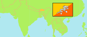
Chukha
District in Bhutan
Contents: Subdivision
The population development in Chukha as well as related information and services (Wikipedia, Google, images).
| Name | Status | Population Census 2005-05-31 | Population Census 2017-05-30 | |
|---|---|---|---|---|
| Chukha (Chhukha) | District | 74,682 | 68,966 | |
| Bjagchhog (Bjacho) [incl. Tsimasham] | Gewog | 10,032 | 6,864 | → |
| Bongo | Gewog | 11,158 | 6,512 | → |
| Chapchha (Chapcha) | Gewog | 3,248 | 2,657 | → |
| Darla (Dala) | Gewog | 10,513 | 8,541 | → |
| Doongna (Dungna) | Gewog | 731 | 1,091 | → |
| Geling | Gewog | 1,856 | 1,609 | → |
| Getana (Getena) | Gewog | 903 | 820 | → |
| Loggchina (Logchina) | Gewog | 2,672 | 2,694 | → |
| Maedtabkha (Metap, Metakha) | Gewog | 539 | 657 | → |
| Phuentshogling (Phuentsholing) | Gewog | ... | 33,444 | → |
| Samphelling (Sampheling) | Gewog | ... | 4,077 | → |
| Druk Yul [Bhutan] | Kingdom | 634,982 | 727,145 |
Source: National Statistics Bureau, Royal Government of Bhutan (web).
Explanation: The population figures of towns and municipalities are generally assigned to an adjacent gewog. Area figures of gewogs are computed by using geospatial data.
Further information about the population structure:
| Gender (C 2017) | |
|---|---|
| Males | 36,041 |
| Females | 32,925 |
| Age Groups (C 2017) | |
|---|---|
| 0-14 years | 17,078 |
| 15-64 years | 48,963 |
| 65+ years | 2,925 |
| Age Distribution (C 2017) | |
|---|---|
| 0-9 years | 10,786 |
| 10-19 years | 12,638 |
| 20-29 years | 16,327 |
| 30-39 years | 12,189 |
| 40-49 years | 7,591 |
| 50-59 years | 4,878 |
| 60-69 years | 2,710 |
| 70+ years | 1,847 |
| Urbanization (C 2017) | |
|---|---|
| Rural | 33,445 |
| Urban | 35,521 |