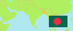
Panchagarh
District in Bangladesh
Contents: Subdivision
The population development in Panchagarh as well as related information and services (Wikipedia, Google, images).
| Name | Status | Transcription | Native | Population Census 1991-03-13 | Population Census 2001-01-22 | Population Census 2011-03-15 | Population Census 2022-06-14 | |
|---|---|---|---|---|---|---|---|---|
| Panchagarh | District | Pañcagaṛa | পঞ্চগড় জেলা | 712,024 | 836,196 | 987,644 | 1,179,843 | |
| Atwari | Subdistrict | Āṭōẏārī | আটোয়ারী উপজেলা | 103,906 | 114,938 | 133,650 | 141,545 | → |
| Boda | Subdistrict | Bōdā | বোদা উপজেলা | 168,258 | 200,693 | 232,124 | 275,279 | → |
| Debiganj | Subdistrict | Dēbīgañja | দেবীগঞ্জ উপজেলা | 159,902 | 185,960 | 224,709 | 267,452 | → |
| Panchagarh Sadar | Subdistrict | Pañcagaṛa Sadara | পঞ্চগড় সদর উপজেলা | 193,198 | 229,237 | 271,707 | 335,353 | → |
| Tetulia | Subdistrict | Tētuliẏā | তেতুলিয়া উপজেলা | 86,760 | 105,368 | 125,454 | 160,178 | → |
| Bangladesh | People's Republic | Bā̃lādēśa | বাংলাদেশ | 106,314,992 | 124,355,263 | 144,043,697 | 165,158,616 |
Source: Bangladesh Bureau of Statistics.
Explanation: The tabulated figures are not adjusted for underenumeration. 2022 subdistrict figures exclude hijra. Some area figures are derived from geospatial data.