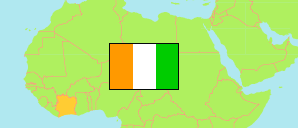
Gontougo
Region in Elfenbeinküste
Übersicht: Gliederung
Die Einwohnerentwicklung in Gontougo sowie verwandte Informationen und Dienste (Wikipedia, Google, Bilder).
| Name | Status | Einwohner Zensus 2014-05-15 | Einwohner Zensus 2021-12-14 | |
|---|---|---|---|---|
| Gontougo | Region | 667.185 | 917.828 | |
| Amanvi | Unterpräfektur | 5.312 | 10.141 | → |
| Appimandoum (Appimadoum) | Unterpräfektur | 6.800 | 9.920 | → |
| Assuéfry | Unterpräfektur | 30.406 | 45.293 | → |
| Bandakagni-Tomora | Unterpräfektur | 9.280 | 11.264 | → |
| Boahia | Unterpräfektur | 9.182 | 11.834 | → |
| Bondo | Unterpräfektur | 19.932 | 28.482 | → |
| Bondoukou | Unterpräfektur | 117.453 | 141.568 | → |
| Diamba | Unterpräfektur | 9.680 | 17.045 | → |
| Dimandougou | Unterpräfektur | 7.159 | 9.190 | → |
| Gouméré | Unterpräfektur | 15.906 | 23.870 | → |
| Kokomian | Unterpräfektur | 10.438 | 15.090 | → |
| Kouassia-Niaguini | Unterpräfektur | 16.872 | 21.522 | → |
| Kouassi-Datékro | Unterpräfektur | 25.833 | 30.328 | → |
| Koun-Fao | Unterpräfektur | 31.982 | 49.280 | → |
| Laoudi-Ba | Unterpräfektur | 56.882 | 98.053 | → |
| Pinda-Boroko | Unterpräfektur | 5.012 | 5.951 | → |
| Sandégué | Unterpräfektur | 23.068 | 26.918 | → |
| Sapli-Sépingo | Unterpräfektur | 8.204 | 12.403 | → |
| Sorobango | Unterpräfektur | 27.744 | 34.797 | → |
| Tabagne | Unterpräfektur | 16.970 | 26.909 | → |
| Tagadi | Unterpräfektur | 34.440 | 35.143 | → |
| Tanda | Unterpräfektur | 51.958 | 69.597 | → |
| Tankessé | Unterpräfektur | 25.378 | 35.940 | → |
| Taoudi | Unterpräfektur | 18.568 | 27.917 | → |
| Tchèdio | Unterpräfektur | 10.605 | 16.740 | → |
| Tienkoikro | Unterpräfektur | 13.417 | 25.409 | → |
| Transua | Unterpräfektur | 36.200 | 46.026 | → |
| Yézimala | Unterpräfektur | 5.796 | 8.829 | → |
| Yorobodi | Unterpräfektur | 16.708 | 22.369 | → |
| Côte d'Ivoire [Elfenbeinküste] | Republik | 22.671.331 | 29.389.150 |
Quelle: Institut National de la Statistique, Republique de Côte d'Ivoire (web).
Erläuterung: Flächenangaben wurden aus Geodaten abgeleitet.