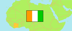
Bafing
Region in Elfenbeinküste
Übersicht: Gliederung
Die Einwohnerentwicklung in Bafing sowie verwandte Informationen und Dienste (Wikipedia, Google, Bilder).
| Name | Status | Einwohner Zensus 2014-05-15 | Einwohner Zensus 2021-12-14 | |
|---|---|---|---|---|
| Bafing | Region | 183.047 | 262.850 | |
| Booko | Unterpräfektur | 18.356 | 22.894 | → |
| Borotou | Unterpräfektur | 5.353 | 5.202 | → |
| Dioman | Unterpräfektur | 4.817 | 6.375 | → |
| Foungbesso | Unterpräfektur | 18.033 | 24.562 | → |
| Gbélo | Unterpräfektur | 4.941 | 6.369 | → |
| Gouékan | Unterpräfektur | 3.246 | 4.592 | → |
| Guintéguéla | Unterpräfektur | 18.994 | 34.575 | → |
| Koonan | Unterpräfektur | 6.553 | 9.970 | → |
| Koro | Unterpräfektur | 23.596 | 33.567 | → |
| Mahandougou | Unterpräfektur | 5.597 | 6.337 | → |
| Niokosso | Unterpräfektur | 6.308 | 8.346 | → |
| Ouaninou | Unterpräfektur | 20.790 | 27.919 | → |
| Saboudougou | Unterpräfektur | 3.918 | 5.225 | → |
| Santa | Unterpräfektur | 9.357 | 11.906 | → |
| Touba | Unterpräfektur | 33.188 | 55.013 | → |
| Côte d'Ivoire [Elfenbeinküste] | Republik | 22.671.331 | 29.389.150 |
Quelle: Institut National de la Statistique, Republique de Côte d'Ivoire (web).
Erläuterung: Flächenangaben wurden aus Geodaten abgeleitet.