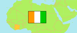
Worodougou
Region in Elfenbeinküste
Übersicht: Gliederung
Die Einwohnerentwicklung in Worodougou sowie verwandte Informationen und Dienste (Wikipedia, Google, Bilder).
| Name | Status | Einwohner Zensus 2014-05-15 | Einwohner Zensus 2021-12-14 | |
|---|---|---|---|---|
| Worodougou | Region | 272.334 | 429.812 | |
| Bobi | Unterpräfektur | 6.994 | 7.138 | → |
| Diarabana | Unterpräfektur | 18.255 | 25.063 | → |
| Djibrosso | Unterpräfektur | 11.859 | 22.484 | → |
| Dualla | Unterpräfektur | 8.130 | 9.996 | → |
| Fadiadougou | Unterpräfektur | 15.066 | 34.552 | → |
| Kamalo | Unterpräfektur | 9.783 | 13.584 | → |
| Kani | Unterpräfektur | 31.211 | 55.109 | → |
| Massala | Unterpräfektur | 23.021 | 40.647 | → |
| Morondo | Unterpräfektur | 15.753 | 19.283 | → |
| Séguéla | Unterpräfektur | 63.774 | 103.980 | → |
| Sifié | Unterpräfektur | 23.667 | 31.264 | → |
| Worofla | Unterpräfektur | 44.821 | 66.713 | → |
| Côte d'Ivoire [Elfenbeinküste] | Republik | 22.671.331 | 29.389.150 |
Quelle: Institut National de la Statistique, Republique de Côte d'Ivoire (web).
Erläuterung: Flächenangaben wurden aus Geodaten abgeleitet.